The Roc de Chère is one of those hikes around Annecy that locals tend to keep to themselves. It’s not quite as famous as the Tournette or the Semnoz, but it’s one of the most beautiful viewpoints on the lake, and it’s completely accessible: moderate elevation gain, well-marked trails, and a national nature reserve that genuinely justifies the detour. If you’re visiting Annecy from the UK and wondering where to go beyond the obvious, this is a solid answer.
I’ve done this loop several times, once in autumn with Rhéa (my dog, who approved) and once in spring when the trailhead car park was already busy by 9am. It’s that kind of place: popular enough that you’re never totally alone, but natural enough to feel like you’ve actually gone somewhere. If you’re looking for roc de chere annecy hikes that go beyond the classic tourist circuits, this one earns its place on your list.
What exactly is the Roc de Chère?

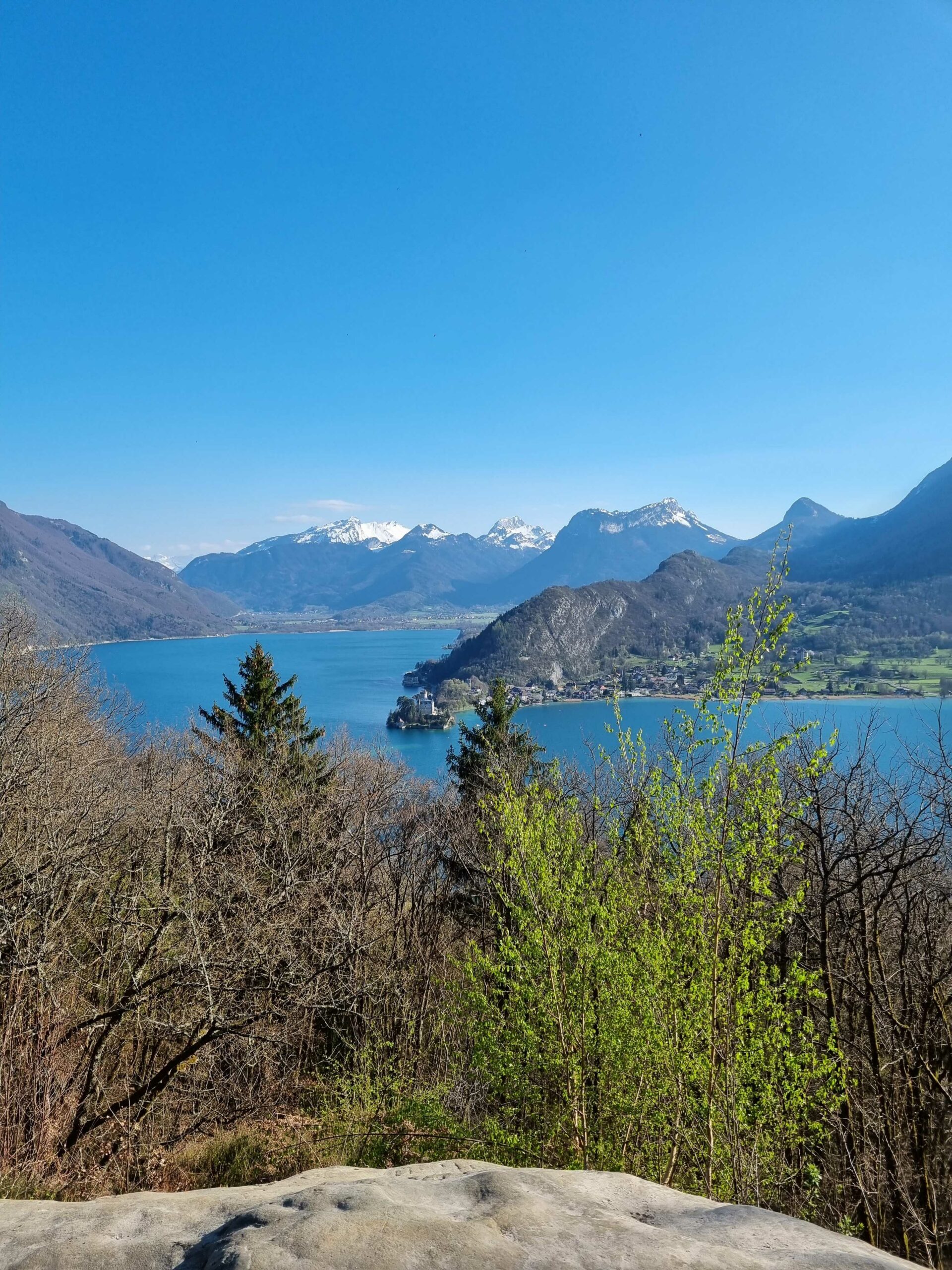
A rocky promontory above Lake Annecy
The Roc de Chère is a rocky headland jutting out between Talloires and Menthon-Saint-Bernard, on the eastern shore of Lake Annecy. It rises to around 580 metres and sits directly above the water, offering a view that takes in the whole southern basin of the lake.
From the main viewpoint, you can see the Talloires bay directly below, the Château de Duingt sitting on its narrow spit of land at the entrance to the Petit Lac, the Bauges massif spreading out in the background, and the Tournette on your right. On a clear day, the colours of the water are extraordinary, especially in the morning or late afternoon light. The kind of view you stop talking to look at.
Lake Annecy is often called the cleanest lake in Europe, and from the Roc de Chère you understand why the description sticks. The water visible from the belvedere is a shade of turquoise that looks almost too perfect. If you’ve come from the UK specifically for the lake, this is the perspective that makes it make sense.
A national nature reserve since 1977
The Roc de Chère has been a national nature reserve (Réserve Naturelle Nationale) since 1977, making it one of the oldest in Haute-Savoie. The reserve covers approximately 68 hectares of woodland, cliffs, and shoreline. This status is not just a label: it comes with real rules, including a ban on picking plants, lighting fires, and leaving marked paths in certain protected areas.
It’s worth knowing before you arrive. The reserve exists for good reason, and the access rules are signposted at the entry points. If you’re used to French national parks having fairly liberal access policies, the Roc de Chère is a bit stricter than average, particularly regarding off-trail walking in the sensitive botanical zones. The signage is clear and the wardens do patrol in summer.
That said, the main trails are all within the permitted areas, and you won’t feel restricted on a standard loop. The rules mainly affect people who want to scramble down to the cliff edge or push through the undergrowth. Stay on the path and you’ll be fine.
Genuinely unusual flora and fauna


What makes the Roc de Chère botanically interesting is the coexistence of two very different ecosystems on the same small site. On one hand, glacial relict species that have survived here since the last ice age: rusty-leaved alpenrose (rhododendron ferrugineux), fir clubmoss (lycopode sélagine), and various lichen species. On the other, Mediterranean plants that have no business being this far north: Montpellier maple, box, maidenhair fern, and madder (garance voyageuse).
That contrast in a single small reserve is fairly unusual for the Alps. The warm, south-facing cliffs create a microclimate that allows the Mediterranean species to hold on, while the sheltered gullies and north-facing slopes retain the conditions that glacial species need. It’s a good example of how local topography can produce biological complexity on a very small scale.
On the fauna side, the reserve is particularly known for its amphibians. Common frogs (grenouilles rousses), fire salamanders (salamandres tachetées), and yellow-bellied toads (sonneurs à ventre jaune) are all present, particularly in the wetter sections of the forest. The yellow-bellied toad is a protected species in France. The peregrine falcon (faucon pèlerin) has been spotted nesting on the cliffs, which explains why some sections are closed to access during the breeding season in spring.
If you’re walking quietly and paying attention, the wildlife rewards you. I’ve seen fire salamanders on wet autumn mornings on the lower trails. They’re unhurried and completely unbothered by people, which makes them strangely satisfying to find.
The viewpoint and what you can see
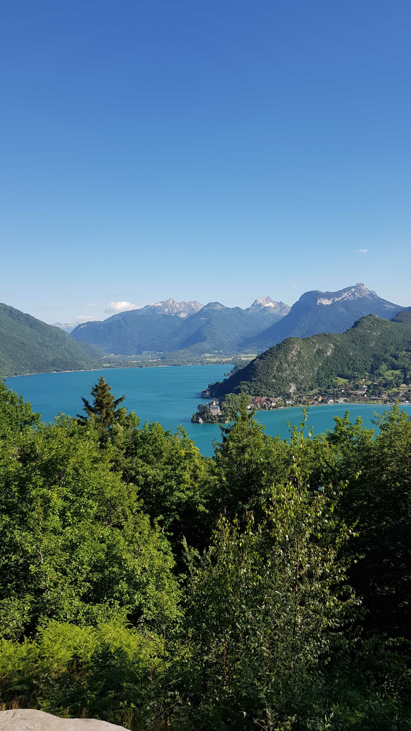
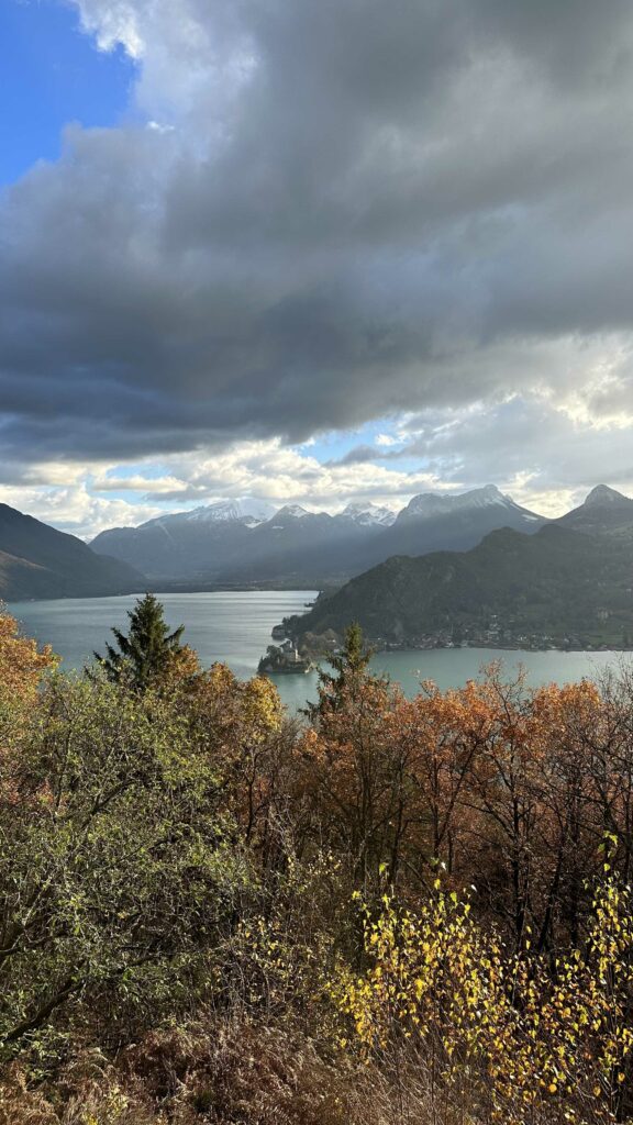
The main belvedere at the Roc de Chère is signposted on all the routes described below. You’ll know you’re there when the trees open up and the lake suddenly appears below you, much closer than you expected.
The view covers: the Talloires bay directly below (the village itself is tucked into the shoreline), the Château de Duingt on its narrow peninsula dividing the two basins of the lake, the Bauges massif behind it in soft grey-blue, and the Tournette ridge on the right. In winter, the Tournette is snow-capped and the contrast with the dark water is striking.
There’s a bench. Use it. Take the time. Have a snack. The walk to this point is not long enough to justify rushing through the view.
At certain points on the ridge, you also get views back towards Menthon and the northern basin of the lake. The château de Menthon is visible from some angles, sitting above the village on its wooded hillside. It’s worth looking for as you walk the ridge rather than waiting only for the main belvedere.
Roc de Chère hiking routes
Several routes cover the Roc de Chère, ranging from easy loops to longer linear traverses. Here’s what I know of each one, with honest assessments. All of them are well within the ability of anyone who walks regularly, including families with children old enough to manage 5-7 km on uneven terrain.
From Menthon-Saint-Bernard: 7.3 km, +290 m/-290 m, 2h30, easy
This is probably the most complete loop. You start from Menthon-Saint-Bernard, a village worth arriving in a few minutes early for the château view alone. The route climbs through mixed forest to the belvedere, follows the ridge above the lake through the heart of the reserve, then drops back down to the village.
7.3 km with 290 metres of elevation gain over 2h30 makes it accessible for anyone who walks a bit regularly. The ascent is steady rather than steep: there are no scrambling sections, no exposed ridges, nothing that would worry a walker unfamiliar with mountain terrain. The paths are well-maintained and clearly marked with the yellow trail signs standard across Haute-Savoie.
One thing to notice near Menthon: the trail passes by the tomb of Hippolyte Taine (1828-1893), a philosopher, historian, and literary critic who was influential in 19th-century French intellectual life. He was a regular visitor to the area and apparently requested to be buried there. It’s a small, quiet spot off to the side of the path, easy to miss if you’re not looking for it.
The route works as an anticlockwise or clockwise loop. I’ve done it both ways; anticlockwise gives you the belvedere earlier in the walk, which suits the morning light and means you’re on the descent when you’re most tired. Personal preference.
The loop from Écharvines: 6.33 km, +229 m/-225 m, 2h30, easy
This is the route I’d suggest if you’re arriving by car and want a straightforward start. The Écharvines car park (see practical info below) is well placed for this loop, which is slightly shorter with a bit less elevation gain than the Menthon option. It passes through the core of the reserve and gives you direct access to the main belvedere.
6.33 km, around 225 metres of ascent, 2h30 at a comfortable pace. Good for a morning outing, with time for a long lunch in Talloires or Menthon afterwards. The trail surface is good throughout; there’s one section with a steeper pitch just before the ridge, but nothing sustained.
This loop works well for families. The car park itself has basic facilities, and the trail is wide enough for the first section that it doesn’t feel like a mountain path. Things do narrow once you’re in the forest, but never uncomfortably so.
From Talloires via the bay
This option starts from Talloires, one of the most beautiful villages on Lake Annecy, sitting at the base of the southern bay. The approach adds a walk along the lake shore before the climb into the reserve, which changes the rhythm of the whole day: you get the flat lakeside section first, then the ascent, then the ridge views.
Talloires is worth the visit in its own right. The village has restaurants, a beach, a medieval abbey converted into a hotel (now famous for its gastronomy), and the kind of lakeside setting that makes you feel like you’ve arrived somewhere rather than just parked. Starting from here adds some kilometres compared to the Écharvines loop, but if you’re combining the hike with time in the village, it makes the logistics simpler.
The traverse from Menthon to Talloires (linear)


If you have two cars (or someone willing to drop you off and pick you up), the linear traverse from Menthon-Saint-Bernard to Talloires is the most satisfying version of the Roc de Chère. You walk the full ridge from one end to the other without doubling back, which gives a more complete sense of the terrain and means you’re seeing new landscape the whole time.
Around 7-8 km one way depending on your exact start and finish points. You can run it in reverse (Talloires to Menthon) if that suits your parking situation better. The elevation is similar in either direction; it’s not a one-way ascent and descent, it’s a ridge walk with gentle ups and downs throughout.
This is the version I’d choose if I was doing the hike with someone who wants the fuller experience. The loops are satisfying, but the linear traverse feels more like a proper walk.
Which route to choose?
If you’re arriving by car and want a simple, satisfying half-day: the Écharvines loop. If you want a bit more context and history along the way: start from Menthon. If you’re combining the hike with time in a lakeside village: start or finish in Talloires. If you have two cars and want the best version of the ridge: do the linear traverse Menthon to Talloires.
All the routes share the same core section: the belvedere and the reserve. The differences are mainly in the approach and the return. You won’t make a wrong choice. The Roc de Chère rewards you on all of them.
Getting there, parking, and practical details


The main car park for the Roc de Chère is the Écharvines car park, located approximately 200 metres before the golf course entrance on the road between Menthon-Saint-Bernard and Talloires (D909 road).
Important: the car park is pay-and-display from May to September. Outside that period it is free. It fills up quickly on sunny summer weekends and public holidays (notably the Ascension and Pentecost weekends in May are very busy), so an early start is worth it. Before 9am in July and August if possible. After 2pm, it often empties out again as morning walkers leave.
By public transport: bus line 20 (SIBRA network) connects Annecy town centre to Talloires and stops at Menthon-Saint-Bernard. Worth checking the timetable at the SIBRA website if you’d prefer to avoid driving. The bus runs year-round, though less frequently outside summer. Coming from the UK, Annecy is accessible by TGV from Geneva (30 minutes), and Geneva is well-served by flights from multiple UK airports. The bus from Annecy station to the trailhead area takes around 30-40 minutes.
Dogs are allowed on the trails but must be kept on a lead within the reserve. The signs are clear about this and it is a legal requirement within the national nature reserve. The trails have no particular obstacles for dogs: no stiles, no scrambling sections, no major water crossings.
There are no refreshment facilities on the trail itself. Bring enough water for 2h30-3h of walking (at least 1 litre per person in warm weather), plus snacks. Restaurants and cafes are available in both Menthon and Talloires at the start or end of the walk.
When to go
The Roc de Chère is accessible year-round, and each season offers something different. The choice partly depends on what you’re after and how you feel about crowds.
Spring (April and May) is beautiful: the forest is coming back to life, the amphibians are active in the wetter sections, and the trails are quiet before the summer season. Some sections can be muddy after rain, particularly on the lower forest paths. This is also when the yellow-bellied toads are most likely to be heard calling near the ponds.
Summer (June to August) is the busiest period. The views are sharp on clear days, the lake water is at its most vivid, and the light on a sunny July morning is genuinely spectacular. But the car park fills early and the main belvedere can be crowded around midday. Start early, or go on a weekday. Bring sun protection: the ridge sections can be exposed and the reflection off the lake increases UV.
Autumn is my favourite time for this hike. The light on the lake in October changes hour by hour, the forest turns gold and orange above the water, and there are far fewer people than in summer. The hike feels quieter, more personal. Mornings can be crisp; bring a layer.
Winter is possible and can be lovely on a clear day, with snow on the distant peaks and a sharp stillness to the air. Check trail conditions before going: some sections can be icy after a cold snap, particularly on north-facing slopes and in shaded gullies. Microspikes are worth having in the car from November onwards.
My tips for respecting the nature reserve
The Roc de Chère is a protected natural site, and the rules of the national nature reserve apply throughout the area. Here’s what that means in practice:
- Stay on marked trails. Leaving the path is prohibited in certain sections of the reserve, both to protect the vegetation and to avoid disturbing nesting birds, particularly the peregrine falcon on the cliff face.
- Do not pick flowers or plants. This applies to all species without exception. The rule exists to protect the reserve’s unusual botanical mix, which took thousands of years to establish.
- No fires, no barbecues, anywhere in the reserve or in the immediate surroundings.
- Take your rubbish with you. There are no bins on the trail. This includes fruit peel and food waste, which may seem harmless but affect local wildlife and soil chemistry.
- Keep dogs on a lead throughout the reserve. It is a legal requirement here, enforced by wardens in summer, and applies to the entire reserve area.
- Avoid loud noise, particularly near the cliff sections where the peregrine falcon may be nesting in spring. Voices carry a long way on the ridge when the lake is calm below.
These rules are not arbitrary restrictions. They are what allows the site to remain what it is: a functioning natural reserve where the wildlife and plants that characterise it can still be found 50 years after the reserve was created. If the roc de chere annecy reserve is still in good condition in another 50 years, it will be partly because of walkers who took these rules seriously.
The Grotte du Grand Perthuis


Near the cliff sections of the Roc de Chère, there’s a cave called the Grotte du Grand Perthuis. It sits in the cliff face rather than at trail level, which means it’s not easily accessible from the main paths, but it’s worth knowing about.
The cave has a layered history: it was apparently used as bathing baths at some point in the past, with the natural rock chambers offering shelter and water access. Local legend also associates the site with counterfeiters who supposedly used the remote cave to mint fake coins without being discovered. Whether or not the legend is accurate, it adds a certain atmosphere to that section of the ridge. The cliffs themselves are impressive in their own right, rising directly from the lake and offering nesting habitat for the peregrine.
The cave is not on the standard walking routes; don’t go looking for it off the marked path. Appreciate it from the trail and let the legend do its work.
What to combine with the Roc de Chère
The Roc de Chère works well as part of a longer day in the area. Here are a few options worth considering depending on your interests and how much time you have.
The Château de Menthon-Saint-Bernard is a few minutes from the trailhead. It is said to have inspired the castle in Sleeping Beauty (Charles Perrault was reputedly familiar with the region), and while that claim is impossible to verify precisely, the building itself is genuinely impressive: a medieval château on a hillside with views down to the lake, still privately owned and open for visits in season. Worth arriving at Menthon 30 minutes before your hike to have a look, or saving it for the end of the walk.
The Cascades d’Angon are approximately 15 minutes by car from Menthon. A short walk from the road leads to two waterfalls, the main one dropping around 60 metres through a narrow gorge. It’s an entirely different landscape from the Roc de Chère, and easily combined into a full day if you want to cover more ground.
The Ermitage Saint-Germain is a small chapel built directly into the rock face above Talloires. It can be reached on foot from the village in about 20-30 minutes on a marked path. It’s a quiet, slightly unexpected spot: the kind of place you wouldn’t know to look for unless someone pointed it out, but once you’ve been there it stays with you.
If you’re planning a full day of hiking in the area and want to explore beyond the Roc de Chère, the Annecy hiking guide lists the best routes around the lake with difficulty levels, elevation, and practical details for each one.
In summary
The Roc de Chère is one of the more rewarding short hikes around Annecy: accessible, varied, and genuinely beautiful in a way that holds up across seasons. The national nature reserve status gives it a character you don’t find on every trail, and the viewpoint over the lake earns the climb on its own.
It’s not a technical hike, it’s not a long one, but it’s one of those places that earns its reputation quietly. The kind of hike you come back to in different seasons because it always gives you something different. If you’re visiting Annecy for the first time, it’s one of the first places I’d send you. If you’ve been before, it’s the kind of walk that reminds you why you came back.
FAQ about the roc de chere annecy hike
Is the Roc de Chère suitable for children?
Yes. The main loops (Écharvines or Menthon) are accessible for children who are comfortable walking 5-7 km on uneven terrain. There are no exposed or technically difficult sections on the main trails. The nature reserve aspect can make the walk more engaging for children who are curious about wildlife, particularly the amphibians in the wetter sections of the forest.
Can I bring my dog to the Roc de Chère?
Yes, but dogs must be kept on a lead throughout the entire nature reserve. This is a legal requirement, not a suggestion, and is enforced by wardens in summer. It applies to the whole reserve area, not just specific sections. The trails have no particular obstacles for dogs.
How long does the roc de chere annecy hike take?
The main loops take around 2h30 at a comfortable walking pace. Add time for the belvedere (you’ll want to stop there, possibly for quite a while), plus any detour towards the Grotte du Grand Perthuis section or the Château de Menthon. A half-day is the right frame: arrive by 9am, finish by early afternoon, have lunch in Talloires or Menthon afterwards.
Is there a fee to access the Roc de Chère?
The hike itself is free. The Écharvines car park is pay-and-display from May to September. Outside that period it’s free. The amount varies by season; check current rates before you go as these can change year to year.
What is the roc de chere nature reserve?
The Roc de Chère became a Réserve Naturelle Nationale (national nature reserve) in 1977. It covers approximately 68 hectares and is notable for its unusual mix of glacial and Mediterranean plant species existing side by side, its amphibian populations including the protected yellow-bellied toad, and the presence of the peregrine falcon on the cliff faces. Specific rules apply throughout: no plant picking, no fires, stay on marked trails, dogs on leads at all times.
How do I get to the Roc de Chère from the UK?
The easiest route from the UK is to fly to Geneva (well-served by multiple UK airports including Gatwick, Heathrow, Manchester, and Edinburgh) and then take the train to Annecy (around 30-35 minutes by TGV). From Annecy, bus line 20 (SIBRA) goes to Menthon-Saint-Bernard and Talloires. By car, the drive from Geneva airport to the Écharvines car park takes around 50-60 minutes depending on traffic. Annecy is also accessible from Lyon airport (around 1h15 by car).