Grand Bassin is a place you discover from above first, leaning on the viewpoint railing and wondering how anyone lives at the bottom of that valley without a road. In late October, during our holiday on Reunion Island (the French island in the Indian Ocean), I walked down there with Cyril on the Bois Court path. The plan: a clear sky, a swim at the foot of the waterfall, a gâteau patate for the picnic… and a climb back that I still remember well. This guide to the Grand Bassin Reunion hike follows the walk as I did it, with the figures from my track, the route, the waterfall, the gîtes (small guesthouses) and everything you need to know so the return does not turn into a slog.
Sommaire
Grand Bassin Reunion: a village with no road at the bottom of the Bras de la Plaine
Where is Grand Bassin?
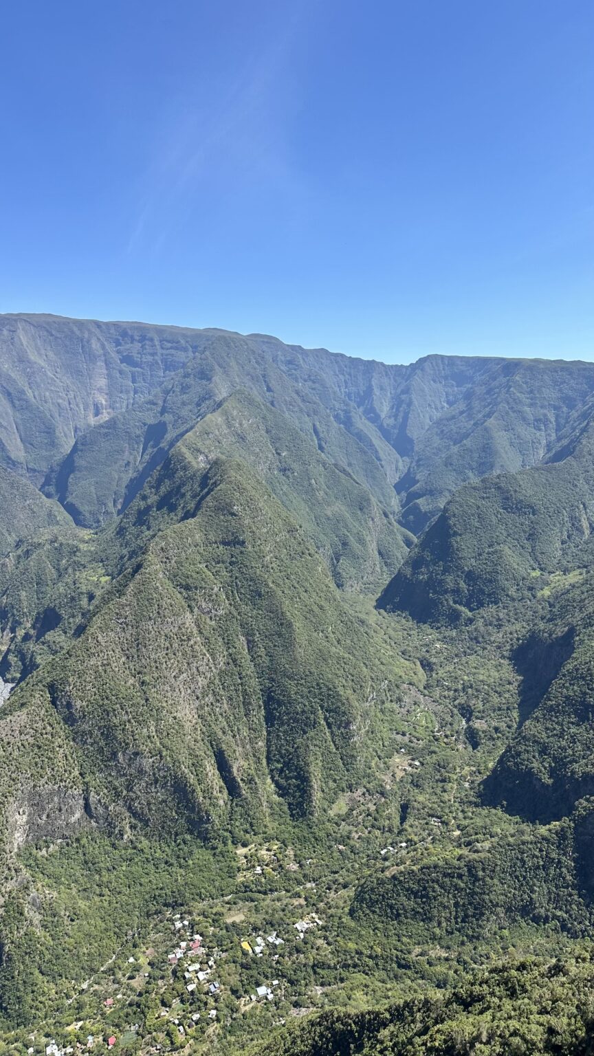
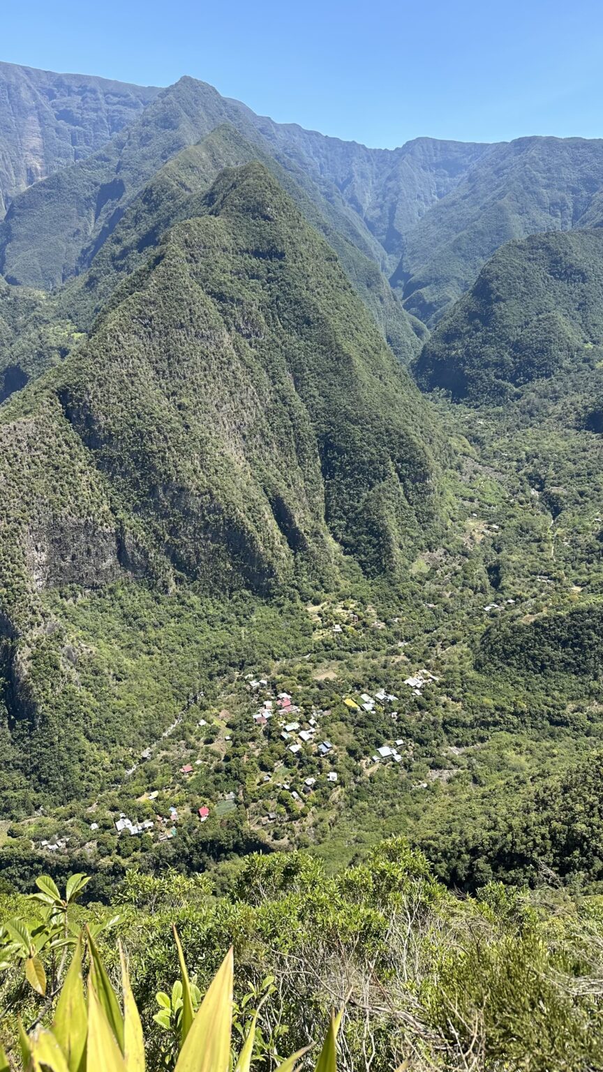
Grand Bassin is a small village (an îlet, as people call them here), at around 700 m of altitude. It sits at the very bottom of the Bras de Sainte-Suzanne valley, which joins the Bras de la Plaine a little further down. It belongs to the commune of Le Tampon, in the south of the island. You reach it from Bois Court, a district of the Plaine des Cafres perched at about 1,350 m. Between the two there is a steep rampart (the sheer cliff walls that frame the island’s valleys) covered in vegetation, and nothing but a path.
No road, then. The villagers bring down their shopping and equipment on a goods lift installed in 1985. Before that, everything was carried on people’s backs up to the Plaine des Cafres (think about that when you climb back with your little daypack, it puts things in perspective). It is sometimes nicknamed the “little Mafate”, and the comparison holds. Grand Bassin has the same feel of an îlet cut off from the world that I loved so much when I crossed the cirque of Mafate (one of the island’s great mountain amphitheatres) on my GR R2.
A quick note: if you search for “Grand Bassin” online, you will also find the sacred lake in Mauritius. It has nothing to do with this walk! Here, I am talking about Grand Bassin on Reunion Island, in the 974 (the island’s department number), on the Plaine des Cafres side.
Grand Bassin hike distance, time and elevation: the figures from my track
I start with the figures, because this is where many people get caught out. On my track, the round trip from the Bois Court viewpoint to the waterfall, via the village, is 10.6 km with 856 m of cumulative elevation gain. We left the viewpoint around 10 am and were back around 3.45 pm, so 5 hours 52 minutes in total, including the swim and the picnic by the water.
| My Grand Bassin hike | The figures |
|---|---|
| Round trip distance | 10.6 km (viewpoint, village, waterfall) |
| Elevation gain | 856 m on my track |
| Total time | 5 hours 52 minutes, breaks included |
| Start | Bois Court viewpoint, 1,404 m on my watch |
| Lowest point | the waterfall, 607 m on my watch |
| Level | hard, mainly because of the climb back up |
Some write-ups quote a different distance, depending on the starting point and on whether they include the waterfall. Check this before you plan your day. As for height, the pure difference in altitude between the viewpoint and the waterfall is about 800 m on my track (from 1,404 m down to 607 m). The cumulative gain is a little higher, because between the village and the waterfall the path goes down and up again, and those small bits add up.
Above all, the elevation on this hike works the wrong way round compared with a classic walk: you go down first, then up. Everything you ran down in the morning, you climb back in the afternoon, with tiredness and heat on top.
Bois Court viewpoint: parking and start of the Grand Bassin trail
To reach the start, drive up to the Plaine des Cafres on the route des Plaines (RN3) from Le Tampon. At the Vingt-Troisième (the 23rd kilometre), take the Bois Court road (D70). It runs straight for about 4 km to the viewpoint. You cannot miss it, as the road ends there.
There is a large free car park, picnic kiosks and shady spots. At weekends it is very busy: Reunionese families spend the day here, and a market is held on Sundays. If you want some peace in the car park, come on a weekday or arrive early.
Once there, take a look at the water clock, a kind of big clepsydra that tells the time, and at the goods lift that goes down to the îlet. The Grand Bassin path starts to the left of the viewpoint. There is only one, so you cannot go wrong.
The view of Grand Bassin from the viewpoint, even without hiking
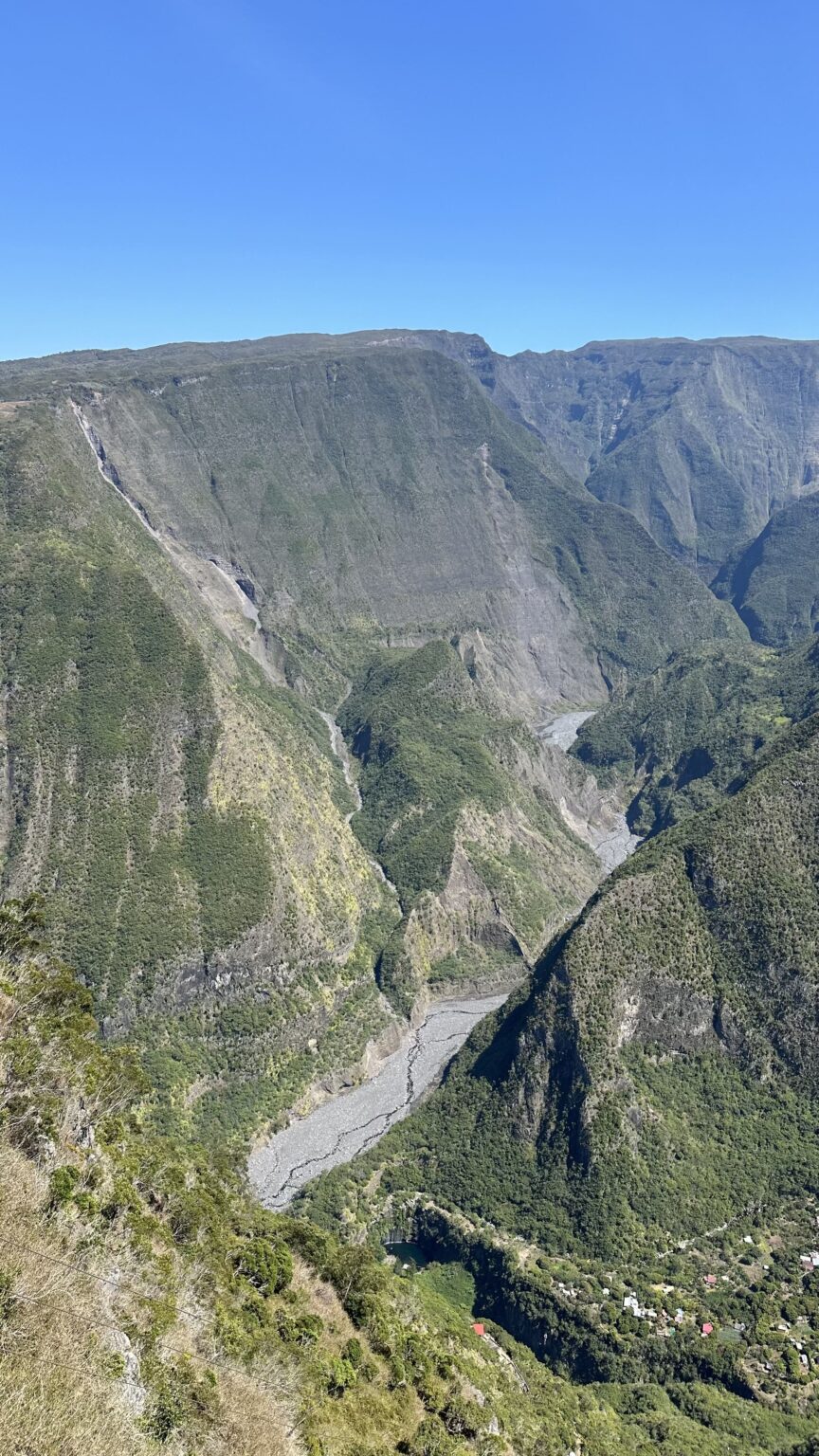
Even if you do not plan to go down, the Grand Bassin viewpoint is worth the detour. The platform juts out over the void and the view drops straight into the valley. Since our visit, the site has been redeveloped: from what recent visitors report, the viewpoint now has a glass-floored walkway (if heights bother you, the view is just as good without stepping onto it). Far below, you can make out the village roofs, tiny in the green, and the Voile de la Mariée waterfall (the Bridal Veil) running down the rampart. Do not confuse it with its namesake in the cirque of Salazie.
The day we were there, the sky was completely clear. We could see everything: the village, the waterfall, the ramparts on each side. Honestly, it was magnificent. As everywhere in the Hauts (the island’s highlands), clouds tend to rise during the day (I saw this at Maïdo), so if you want the view, come in the morning.
Grand Bassin Reunion hike: the route
The Grand Bassin route is easy to follow: a single path that goes down the rampart to the village, then a small waymarked path to the waterfall. There are no navigation traps. The difficulty lies elsewhere.
Going down to the îlet: easy on the lungs, hard on the knees
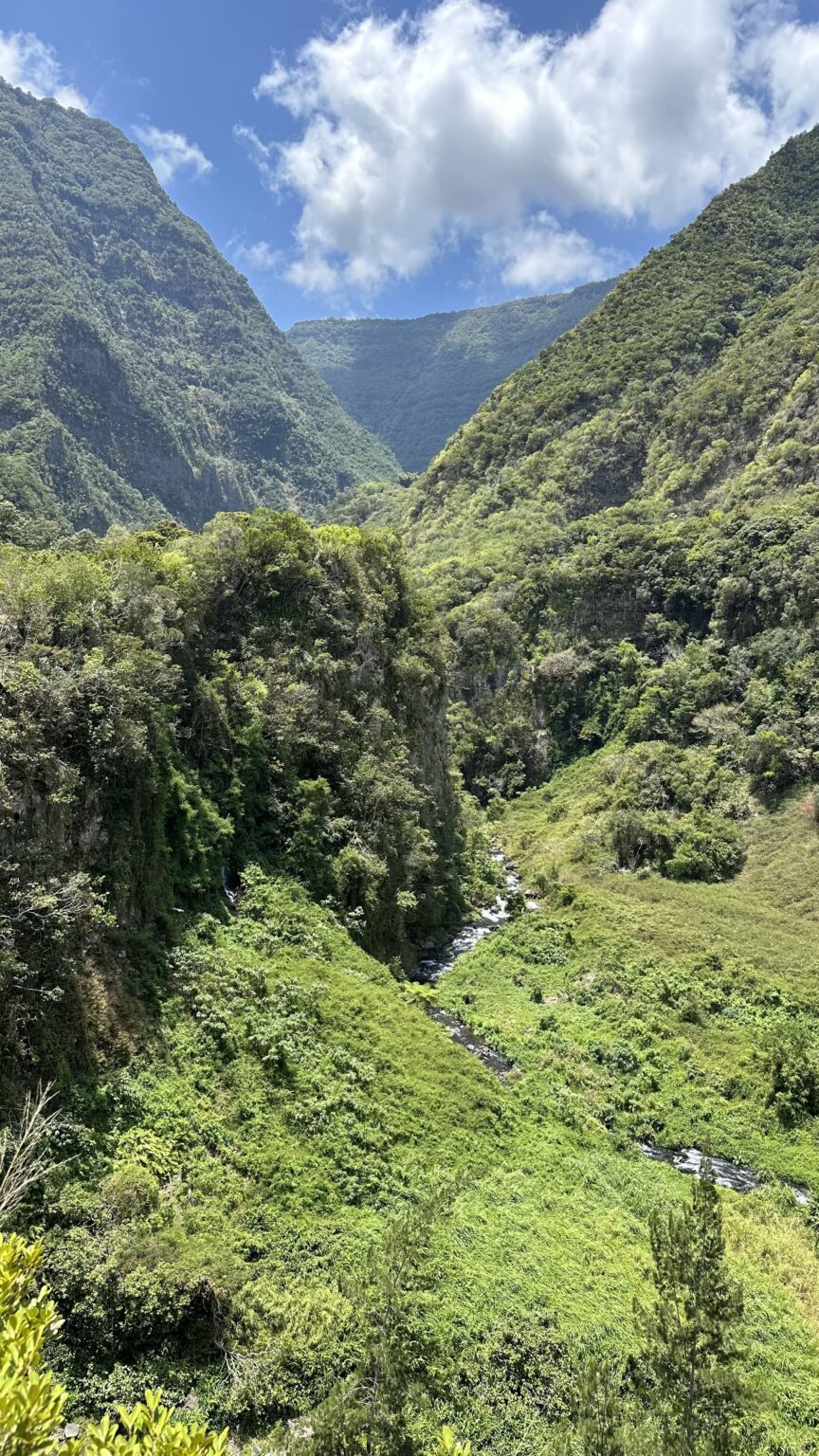
The Grand Bassin path goes down in zigzags along the slope, with steps in places. It is well maintained, and the view over the valley stays with you at almost every bend. Most hikers take between 1 hour 30 and 2 hours to reach the village, a little longer if you stop often for photos (and you will stop, trust me).
This is the most pleasant part of the day, but also the most deceptive. You go down fast, your breathing is fine, and the hike feels easy. Your knees, meanwhile, take several hundred metres of descent without a break. If you have poles, this is the moment to get them out.
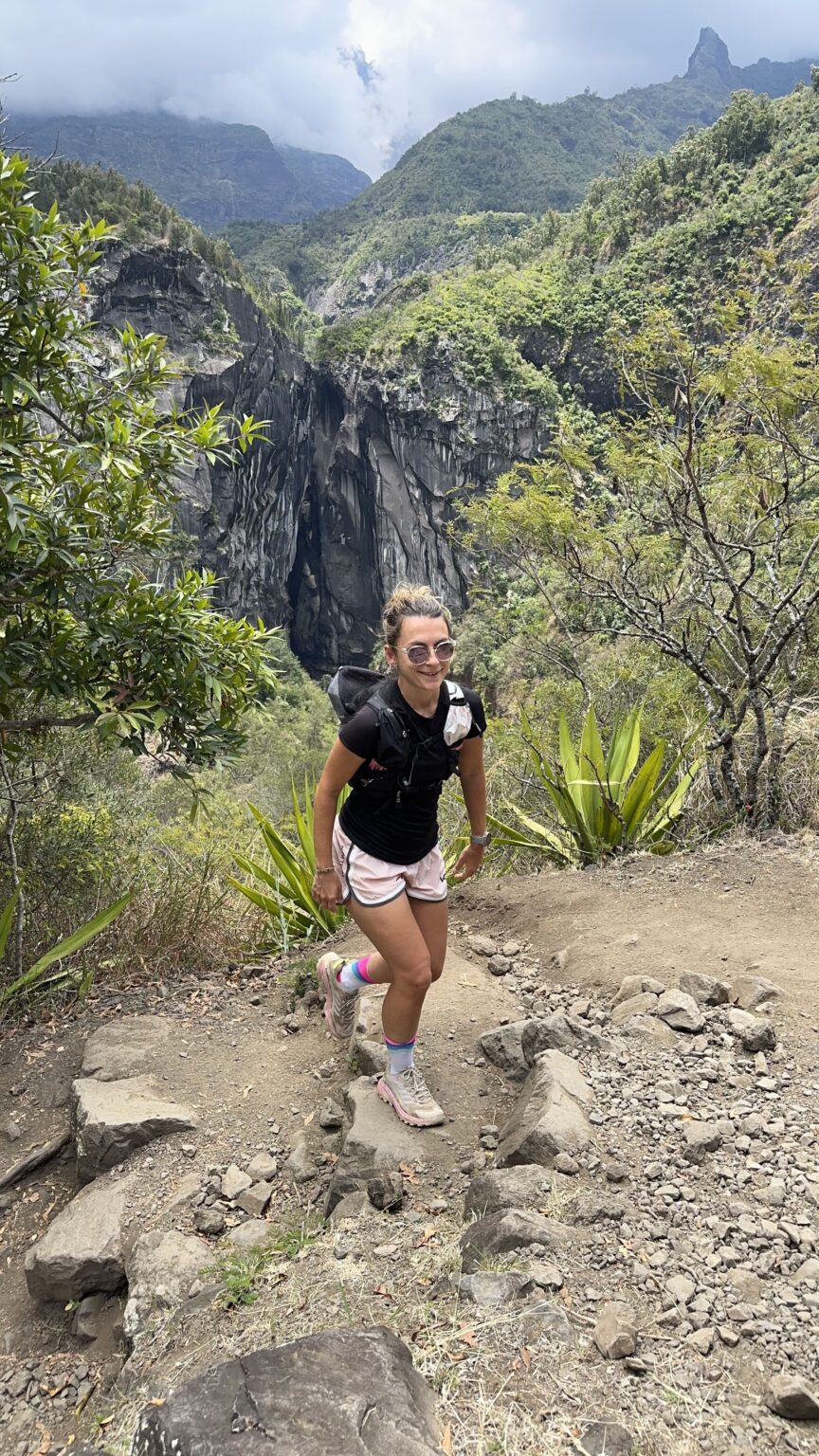
About halfway down, there used to be a water point at a pumping station. Reports disagree: some say it no longer works, while others filled their bottle there recently. To be safe, set off with all your water.
Walking through the village of Grand Bassin
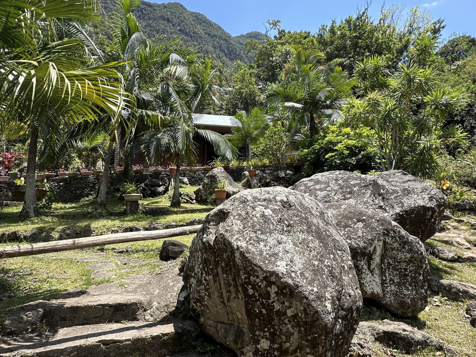
At the bottom, you cross a bridge and enter the village. There are wooden and tin-roofed houses, gardens, terraced crops, a small chapel and a few gîtes. There are also a few places for a drink or a bite to eat, but for a meal you need to book ahead.
We did not stop, as we had the waterfall in mind. But I have to admit it: walking through the village, I badly wanted to spend the night there. The calm, the gardens, that feeling of having reached the end of the world after only an hour and a half of walking… If I did it again, I would book a gîte (more on that below).
Keep in mind that this is a place where people live before it is a hiking stop. The residents are at home, so walk through quietly, say hello, and do not step into private yards for a photo.
From the îlet to the Voile de la Mariée waterfall
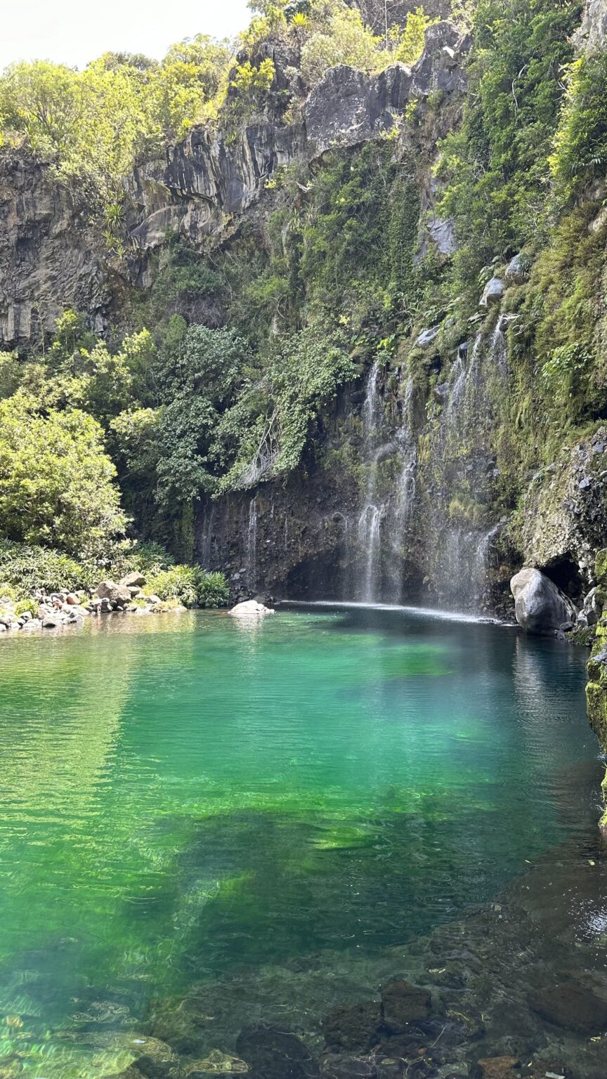
From the village, follow the signs for the “sentier de la cascade” (waterfall path). Less than a kilometre remains, and the waymarking is not always obvious. Carry on to the La Cascade gîte, then take the small path that runs along the river. It drops towards the Bras de Sainte-Suzanne, which you have to cross. Depending on the water level, you either hop from stone to stone or get your feet wet. After the crossing, a short climb, rather steep at first, takes you to the foot of the waterfall.
And there you understand where the name Grand Bassin comes from (a bassin is a basin or pool). The Voile de la Mariée waterfall, several dozen metres high, falls into a vast pool surrounded by rocks and vegetation. After the descent, it is quite a reward.
The map and my elevation profile
You can see my Grand Bassin track on this map: my Grand Bassin route on Google Maps.
The profile looks like a big V: a long descent from the viewpoint to the village, a few small roller-coaster bumps between the îlet and the waterfall, then the same slope to climb in the other direction. When you look at the profile before leaving, you immediately see where most of the effort lies.
https://www.google.com/maps/d/viewer?mid=1TT_DA2sN1lx5VNtj4_zJOHZ9eQd0bHoSafety and respecting nature at Grand Bassin
Before I talk about swimming, a short pause on safety, because this hike combines several pitfalls.
Do not set off during or just after heavy rain. The river crossing before the waterfall can become dangerous when the flow rises, and the level of a Reunion river can change very quickly. Check the weather and the Météo-France warnings the day before and on the morning itself. If it has rained a lot, postpone or stop at the village.
Plan for the heat. It is hot at the bottom of the valley and on the rampart, and shade is rare on the climb back. Set off early so you are not climbing at the hottest hours. Take plenty of water, a cap and sun cream.
Respect the îlet and its residents. Grand Bassin is not a film set. Stay on the path, do not pick anything in the gardens, ask before photographing anyone and keep the noise down as you walk through the village.
On the path and in the water
Carry out all your rubbish. Here, everything that goes down has to come back up, whether by the goods lift or in the residents’ bags. Do the same with your wrappers, including fruit peel and tissues.
Do not cut the zigzags. The rampart is steep and the ground is fragile. Cutting the bends damages the path and speeds up erosion.
Be careful in the water. The water is cold and the bottom is rocky. Do not dive in without knowing the depth, and do not stand right under the fall, where stones can come down.
Tell someone your route, especially if you are walking alone, and keep a head torch in your bag in case the climb back takes longer than planned.
Grand Bassin waterfall: swimming and picnic stop
When we arrived at the Grand Bassin waterfall, there were quite a few people. But the place is big and everyone settles around the pool, on the rocks or on the grass, so we easily found our spot.
We swam, of course. After the descent, it was exactly what we wanted. Be ready, though: the water is cold, really cold, and it takes your breath away. But once you are out, with the sun on the rocks, you feel brand new.
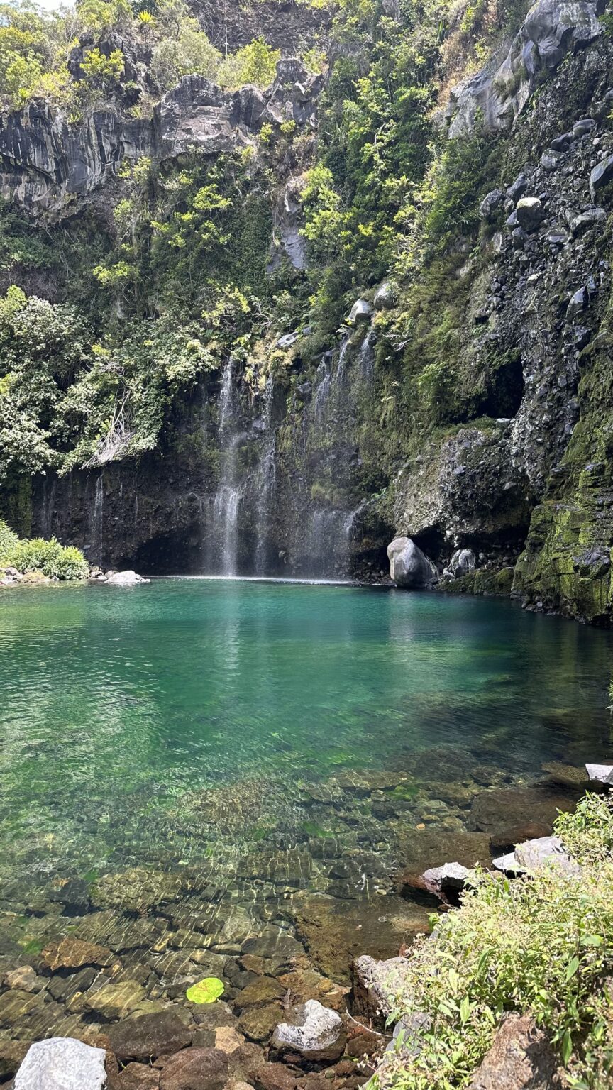
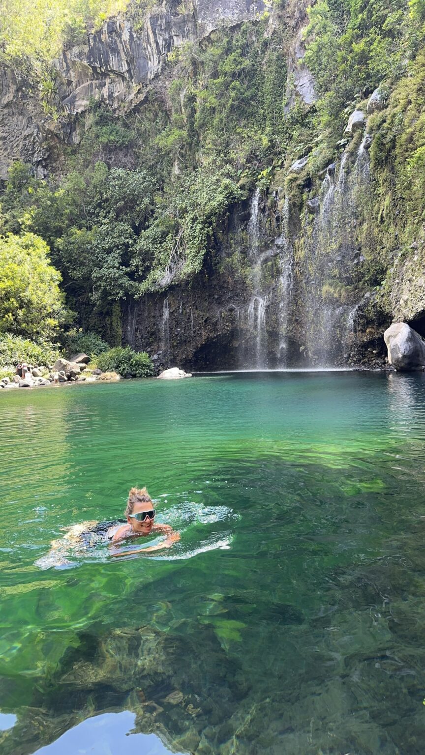
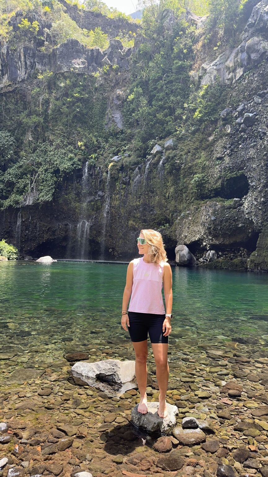
Then it was picnic time, with a gâteau patate for dessert. If you do not know it, it is a Reunionese cake made with sweet potato, soft and fragrant, found almost everywhere on the island. Eating that at the foot of the waterfall, feet still wet, is one of my best memories of the trip.
My advice: take your time here, as this is the heart of the day. Just keep an eye on the clock. The longer you linger, the more you climb back at the hottest time.
The climb back: the real test of the Grand Bassin hike
I will not lie to you: the climb back from Grand Bassin was hard. It was extremely hot, the air was heavy, and it goes up non-stop. We found it long, very long.
It happens in two stages. First, you go back from the waterfall to the village. You have to cross the river again, and the start of the climb is steep, then it eases off. After that comes the real section: the rampart, with its zigzags in full sun. Every metre you went down smiling in the morning has to be climbed back, one by one. Most hikers allow between 2 hours 30 and 3 hours for the climb, sometimes more with plenty of breaks, which matches what we felt.
What helped me, and what I recommend:
- Find your rhythm and keep it. It is better to climb slowly without stopping every ten metres. Short, regular breaks are better than one long break where your legs cool down.
- Drink often, in small sips, before you feel thirsty.
- Wet your cap at the waterfall or in the river before setting off.
- Keep an easy snack for the second half of the climb.
- Use your poles. On a slope like this, they really take the load off your legs.
And if you know in advance that it will be too much, the best solution is to sleep at Grand Bassin and climb back the next morning, in the cool. That is exactly what I would do if I went back.
Is the Grand Bassin Reunion hike easy or hard?
Hard. Not because it is technical: the path is good and there is no scary section. What makes the Grand Bassin hike demanding is the sequence of a long descent, a swim that tires your legs and a climb of about 800 m in the heat.
Back home in the Haute-Savoie, we set off in the cool of the morning, climb, then come down gently in the afternoon. At Grand Bassin, it is the other way round: the effort comes at the end of the day, when you are already tired and it is at its hottest. That is what changes everything.
If you walk regularly and have already done hikes with 800 m of elevation gain, it is perfectly doable, as long as you start early. If you are a beginner, start with shorter walks (I have listed several in my Reunion Island hiking guide) or split the hike over two days with a night in a gîte.
When to go and what time to start
We went at the end of October, with bright sun and a lot of heat. The dry season, roughly May to November, is the most pleasant for hiking on Reunion Island. In the rainy season, the river and the paths call for much more caution. On the other hand, when it has not rained for a long time, the waterfall can shrink to a few trickles, and some hikers found it almost dry.
For the start time, the earlier the better. We started around 10 am and did the whole climb in the early afternoon, at the hottest time: I advise you to leave well before that. You enjoy the view from the viewpoint before the clouds, you go down in the cool, you have the waterfall to yourself for longer and you climb back before the worst of the heat. Avoid Sundays if you do not like crowds in the car park.
Sleeping in a gîte at Grand Bassin, Reunion Island
We did not do it, and it is my only regret about this hike. The village of Grand Bassin has several gîtes and guesthouses (a gîte is a small guesthouse), often with a table d’hôte (a set meal shared at the guesthouse). Among them you will find, for example, gîte La Cascade, Le Paille en Queue, Les Mimosas or Auberge Grand Bassin chez Kévin. Many hikers also recommend booking a night on site. As everywhere in the îlets, you need to book ahead, both for the night and for the meal.
Sleeping in a gîte at Grand Bassin changes the whole hike:
- A gentle descent, without watching the clock;
- The waterfall in the afternoon, once the day hikers have left;
- An evening in the village, in peace, over a Creole meal;
- The climb back the next morning, in the cool, with rested legs.
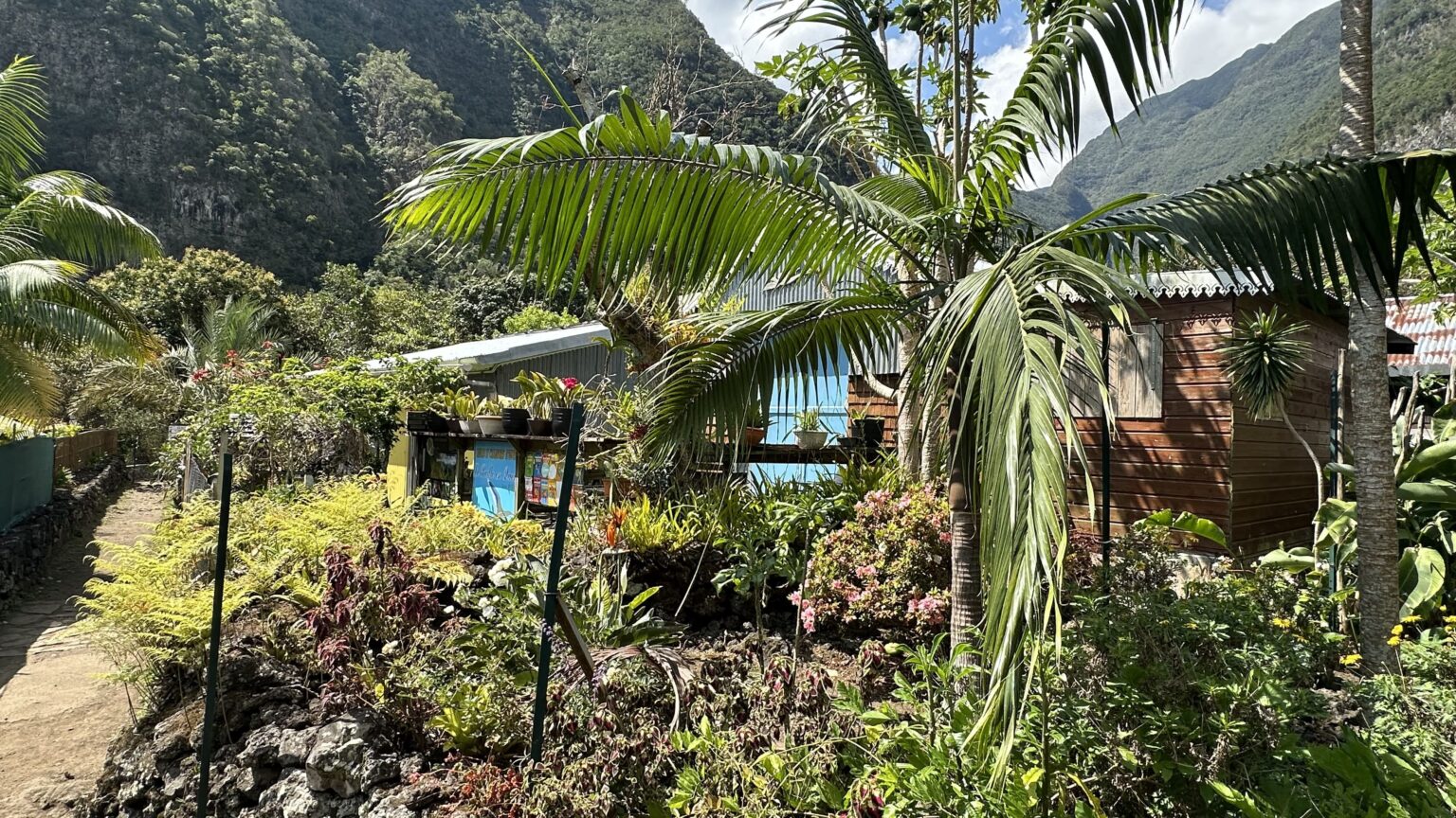
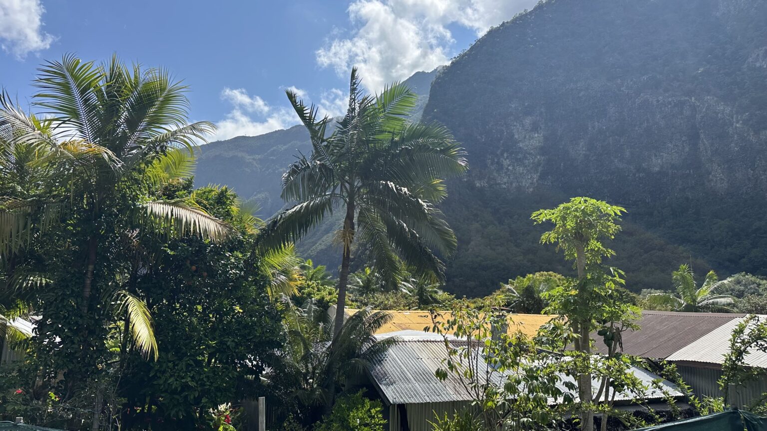
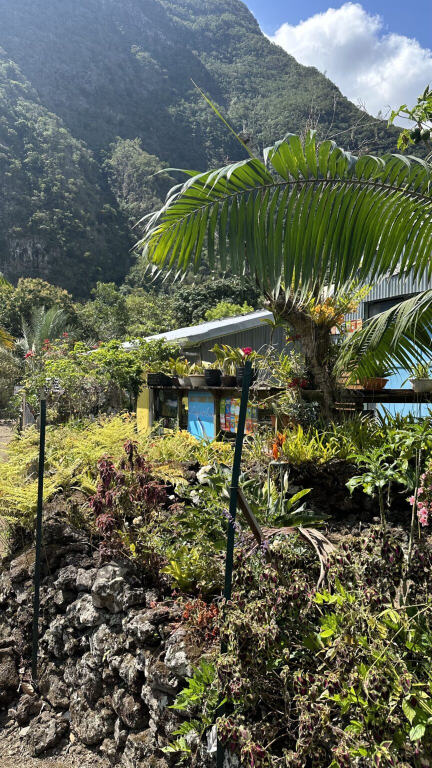
If you prefer to sleep up top, there are also rentals and gîtes at Bois Court and on the Plaine des Cafres, sometimes a few minutes’ walk from the start of the path. It is handy for setting off down very early.
What to pack
For the Grand Bassin day hike, here is what I put in my bag:
- Good hiking shoes with a grippy sole, for the steps and wet rocks.
- Poles, mainly for the climb back.
- Plenty of water. There is no reliable water point on the path.
- Cap, sunglasses, sun cream and mosquito repellent.
- Swimsuit and microfibre towel for the swim.
- Picnic and snacks, sweet and savoury.
- A small first-aid kit, with something to treat a blister.
- Head torch, in case the climb back drags on.
- A bag for your rubbish.
- Some cash if you plan to drink or eat something in the îlet. I do not know whether cards are accepted everywhere, so it is better to be prepared.
If you sleep at the gîte, add a change of clothes and something warm for the evening.
Frequently asked questions
How long does the Grand Bassin hike take?
Allow between 1 hour 30 and 2 hours to go down to the village and between 2 hours 30 and 3 hours to climb back. With the round trip to the waterfall, the swim and the picnic, we took 5 hours 52 minutes in total.
How much elevation does the Grand Bassin hike have?
Between the Bois Court viewpoint and the bottom of the valley, there is a difference in altitude of about 800 m (from 1,404 m to 607 m on my track). With the small climbs between the village and the waterfall, my track shows 856 m of cumulative elevation gain over 10.6 km round trip.
Can you drive to Grand Bassin?
No. The village can only be reached on foot. You can park at the Bois Court viewpoint, on the Plaine des Cafres, then walk down the path.
Can you swim at the Grand Bassin waterfall?
Yes, we swam in the pool at the foot of the waterfall. The water is very cold. Avoid swimming and crossing the river during or after heavy rain, and do not stand under the falling water.
Is there water on the path?
There is a water intake halfway, but opinions are split: some filled their bottle there, others say it no longer works. Set off with all the water you need for the day.
Do you need to book a gîte at Grand Bassin?
Yes. The gîtes in the village are small and run on reservation, for the night as well as for the meal. Book before you go down.
Is Grand Bassin in Reunion Island or Mauritius?
Both exist! Grand Bassin on Reunion Island is an îlet in Le Tampon, reached on foot from Bois Court. In Mauritius, Grand Bassin is the name of a sacred lake, which has nothing to do with this hike.
When is the best time to do the Grand Bassin hike?
The dry season, roughly May to November, is the most pleasant for hiking on Reunion Island. Start as early as you can: you get the view before the clouds, the descent in the cool and the waterfall with fewer people. We went at the end of October and it was very hot. When it has not rained for a long time, the waterfall can shrink to a few trickles.
Is the Grand Bassin hike hard?
Yes, I would call it hard. The path is good and there is no scary section, but you go down about 800 m first and have to climb all of it back, in the heat. If you walk regularly and have done hikes with 800 m of elevation gain, it is doable when you start early. Otherwise, split it over two days with a night in a gîte.
Can you sleep at Grand Bassin?
Yes. The village has several gîtes and guesthouses, such as gîte La Cascade, Le Paille en Queue, Les Mimosas and Auberge Grand Bassin chez Kévin. Book ahead, for the night and for the meal. I did not stay myself, but it is the first thing I would change if I did the hike again.
What should I take on the Grand Bassin hike?
Take good hiking shoes, poles for the climb back, plenty of water, sun protection, a swimsuit and a towel, a picnic, a head torch and a bag for your rubbish. Bring a little cash for the îlet too.
All my articles on Reunion Island
If you are planning your trip, here are my other articles on the island:
- Reunion Island hiking: my favourite hikes on the island
- Reunion Island holidays: 10-day itinerary and things to do
- Reunion Island hiking: our GR R2 trek in 11 days
- Piton des Neiges hike: refuge, route and practical tips
- Piton de la Fournaise hike: route, timings and tips
- Maïdo, Réunion Island: sunrise, getting there and what to do
- Cirque de Mafate: how to visit, hiking routes and gîtes
- Cirque of Salazie: discovery, hikes and waterfalls on Reunion Island (currently in French only)
- Trou de Fer, Reunion Island: hike, viewpoint and panorama