We saw the Piton de la Fournaise long before we climbed it. During our traverse of La Réunion on the GR R2, we walked along its edge on the way to the hut, telling ourselves we would come back. We kept that promise on holiday: at the end of October we left the Pas de Bellecombe car park a little before 3am for this Piton de la Fournaise hike, up to the rim of the Dolomieu crater.
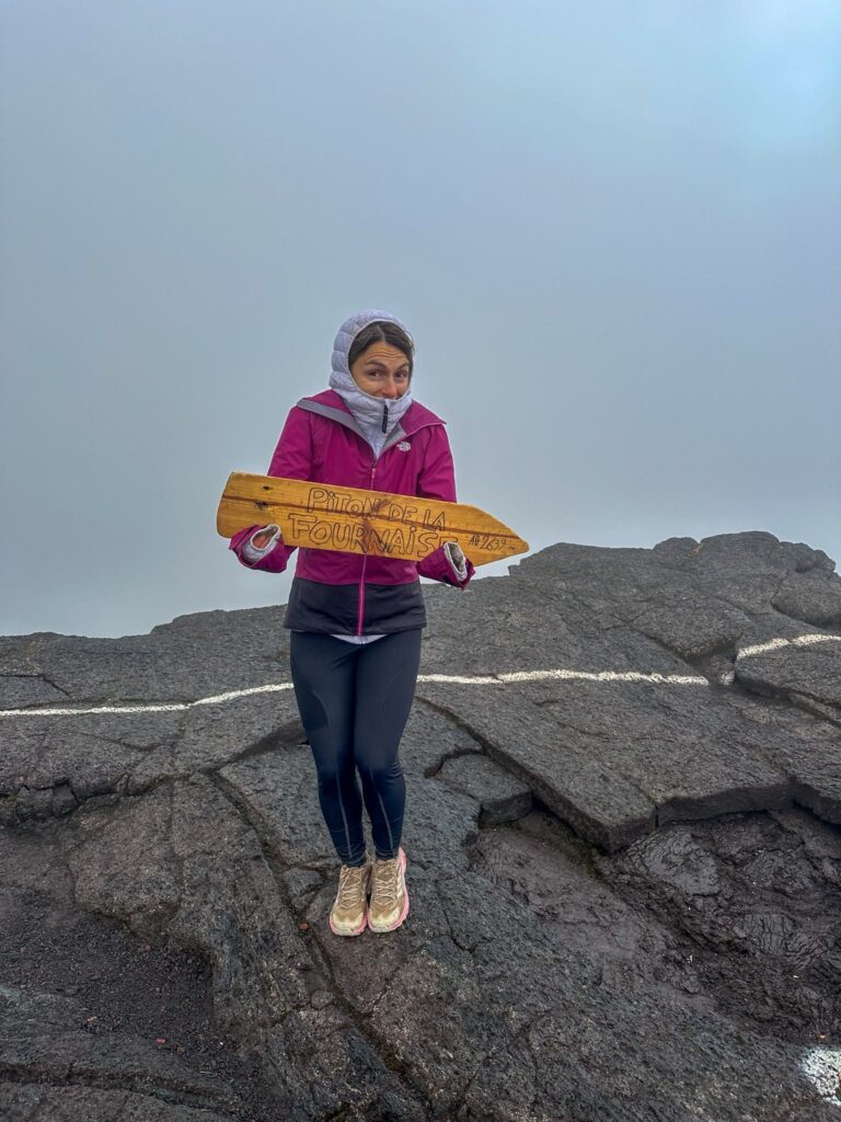
I was frozen, everything up there was covered in cloud and we saw no sunrise (I was gutted, I won’t pretend otherwise). But on the way down the volcano finally came out of the clouds, and it was beautiful. I’ll tell you how it went. You’ll find the figures from my track, the route, the weather, the safety advice and where to sleep. If you only know the Piton de la Fournaise volcano from the news, this is what the walk itself is like.
Piton de la Fournaise: practical information before you go
Where is the Piton de la Fournaise located?
The Piton de la Fournaise is an active volcano in the south-east of La Réunion, the French island in the Indian Ocean. A station of the Institut de physique du globe de Paris, the Observatoire volcanologique du Piton de la Fournaise (OVPF), has monitored its activity since the end of 1979. The Pas de Bellecombe, where the hike starts, has the same postal address as the Gîte du Volcan (a mountain lodge, gîte being the French word for it) in Sainte-Rose, right next door.
You get there by the Route Forestière du Volcan (the RF5) from the Plaine des Cafres: 22.5 km, about 50 minutes by car, up to the Pas de Bellecombe car park. No public transport goes up there, so you will need a car.
Piton de la Fournaise height and elevation gain: the figures from my track
Here is my Strava track from the night climb. I have put it next to other tracks (Visorando, Openrunner and Komoot) so you can see how much the numbers vary.
| My track | Other tracks | |
|---|---|---|
| Distance (return) | 14.2 km | 11.7 to 12.5 km |
| Elevation gain | 590 m | 507 to 594 m |
| Altitude at the start | 2,369 m | 2,311 to 2,350 m depending on the source |
| High point | 2,496 m | 2,481 to 2,486 m |
| Duration | 6h44 in total, including about 2h of stops | 5h01 (Komoot) |
The summit of the massif is at 2,632 m (about 8,635 ft) according to the OVPF, but that is not where the path takes you: you stop at the edge of the Dolomieu crater, a little above 2,480 m. The figures change from one track to the next, so take mine as a guide rather than gospel.
My track is the longest on the list. It shows about 5 km walked above 2,440 m, between 4:20am and 6:55am: I didn’t simply reach the crater rim and turn round. I’ll go through it hour by hour further down.
An active volcano: check access to the enclos before you set off
Access to the Enclos Fouqué, the huge caldera around the crater, depends on the ORSEC Volcan system (the island’s emergency plan for eruptions). These are its alert levels, from a DEAL de La Réunion document:
- Vigilance: persistent activity beneath the massif.
- Alert 1: an eruption is likely or imminent. Access to the enclos is forbidden by prefectoral order.
- Alert 2: an eruption is under way (2.1 inside the enclos with no threat, 2.2 with a direct or indirect threat, 2.3 outside the enclos).
- Safeguard: the eruption is over.
I’m deliberately not giving you the current status of the enclos. It changes from one month to the next: the OVPF published bulletins at alert 2-1 in January 2026, then at alert 2-2 in April. The day before you leave, look at the OVPF bulletins, the orders issued by the prefecture of La Réunion and the ONF trail map (it has a Volcan zone). Check again on the morning itself. If access is closed, there is nothing to discuss.
There is another viewpoint on the island: the Maïdo, which overlooks the cirque of Mafate. You can drive up, and my article on the Maïdo covers the access and the hike to the Grand Bénare.
Pas de Bellecombe: car park and start of the hike
The road ends at the Pas de Bellecombe (pas means a pass), a viewpoint over the Enclos Fouqué. Most of the volcano’s activity is concentrated in this caldera. The car park is large, and the turning for the Gîte du Volcan is a few minutes before it.
On my track the walk starts at 2,369 m, at 2:51am. The first 1.3 km are steps going down into the enclos: I am at 2,247 m by 3:11am. Visorando warns that the path sometimes drops quite steeply and that the steps are high. You also go through a metal gate, if it is open. Keep in mind straight away that you will climb those steps again, in the other direction, at the end.
I found no official source on a parking fee or an entry charge, so I’m not giving you one. Visorando also says you can start from the Gîte du Volcan car park, for almost the same duration.
Piton de la Fournaise hike: the route to the Dolomieu balcony
The route follows the path that the prefecture describes like this: Pas de Bellecombe, Formica Leo, then the path to the Dolomieu crater viewing area, along the north of the crater (January 2022 press release). I did it at night, so I may as well say it: I saw almost nothing of the enclos on the way up. What I describe comes from my track, from the descent and from the sources I read.
Crossing the enclos of the Piton de la Fournaise
Once you are at the bottom of the steps, my track is almost flat, between 2,223 and 2,253 m. It lasts about 2 km, from 3:21am to 3:52am. According to Visorando, the scenery changes completely at the foot of the stairs.
I have no description to give you of this part: at night you can hardly see anything. Fournaise.info talks about a slope that gets steeper and steeper as you climb, with different types of frozen lava.
The Formica Leo and the final climb
The Formica Leo is a reddish-ochre volcanic cone, dated 1753 according to Fournaise.info. Climbing it is not advised: the site says it is constantly eroding.
The real climb comes after that. On my track it starts around 3:52am at 2,253 m and goes straight up to the crater rim: 230 m of ascent over 1.8 km, covered in 40 minutes, to reach 2,484 m (about 8,150 ft) at around 4:32am.
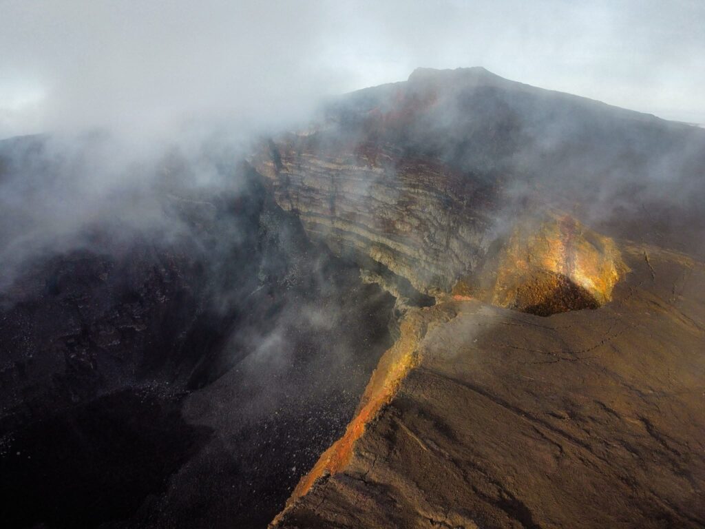
Fournaise.info points out that the end of the route crosses recent lava flows with a crumbly crust. The path is not dangerous in itself, but the climb is gruelling. At the Dolomieu observatory, according to the same site, a white line marks the limit you must not cross, and the crater drops about 300 m deep. On my morning everything was covered in cloud: I did not see the crater.
Piton de la Fournaise map and my route profile
The map I made on My Maps shows the start at the Pas de Bellecombe, the Enclos Fouqué, the Formica Leo cone and the edge of the Dolomieu crater, with my track. Open it on your phone before you leave: the Département’s hikers’ advice booklet recommends downloading the map in advance, so that your app can follow you even without a signal.
For the altitude step by step, the timeline below gives my key passing points.
Safety and respect for nature
The Piton de la Fournaise is a volcano, and you remember it most when you cannot see anything in front of you. Fournaise.info advises extreme caution in strong wind, in fog and above all at night. That more or less describes my outing. Follow the waymarks without losing sight of them, stay behind the observatory’s white line and do not climb the Formica Leo.
Black lava reflects UV strongly, again according to Fournaise.info, so bring sun cream and a cap: you will be walking back down in daylight. The same site advises carrying a survival blanket, a torch and a first-aid kit, and the Département’s booklet adds a power bank for your phone.
Take all your rubbish home with you, organic waste included, which is the rule in the Département’s booklet, and which also asks you not to disturb the wildlife. For rescue, call 112, or the PGHM, the mountain gendarmerie, on 02 62 930 930 (both numbers are in that booklet). Fournaise.info warns that mobile coverage does not reach everywhere in the volcanic areas: don’t rely on your phone alone, and download your map before you leave.
Climbing at night for the sunrise: my real timeline
This is my climb of 30 October 2024, from my Strava track (La Réunion time):
- 2:51am: start at the Pas de Bellecombe, 2,369 m.
- 3:11am: bottom of the steps, 2,247 m (km 1.3).
- 3:21am: floor of the enclos, 2,223 m (km 2).
- 3:52am: start of the climb, 2,253 m (km 3.9).
- 4:32am: arrival at the crater rim, 2,484 m (km 5.7).
- 5:21 to 5:55am: a 33-minute pause at around 2,490 m, waiting for the sunrise.
- 6:41am: high point of my track, 2,496 m (about 8,189 ft) (km 9.5).
- 6:55am: start of the descent.
- 8:00am: back on the floor of the enclos, 2,229 m (km 12.4).
- 9:35am: end of the track, 14.2 km.
In total I spent about 2h35 above 2,440 m (from 4:22am to 6:57am). We waited for the sunrise, but everything was covered: we saw nothing and I was frozen. Fournaise.info advises setting off early to enjoy the cool of the morning. Leaving at night gives you the margin to be up there before daybreak. It does not guarantee you will see anything at all.
Piton de la Fournaise weather: cold, cloud and a plan B
I have no official source for the temperatures at the crater rim, so I’m not giving you any figures. What I do know is that I was very cold up there and that a cloudy sky cannot be ordered. Look at the Météo-France forecast the day before and on the morning itself. Checking the route and the weather is the first reflex in the Département’s booklet.
My plan B, if you find yourself in the grey, comes down to two ideas. Don’t judge your day by what you see at the crater rim: on my hike the volcano came out during the descent, not at sunrise. And if you sleep at the Gîte du Volcan, about 600 m from the entrance to the crater, you can decide on the spot when you wake up. You look at the sky and you choose.
The descent: when the volcano comes out of the clouds
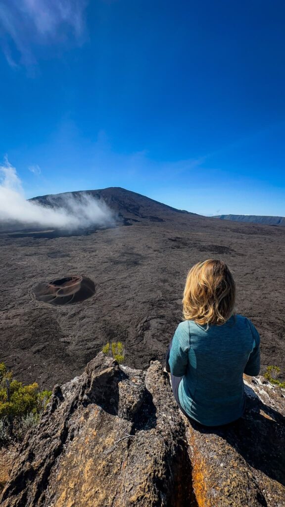
Around 6:55am we started going down, and that is when the volcano began to clear. It was beautiful. The way up had been in the dark: this descent was the chance to finally see the Enclos Fouqué in daylight.
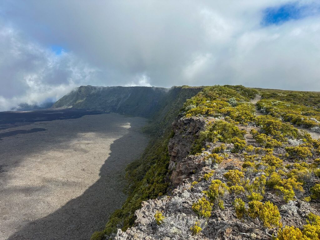
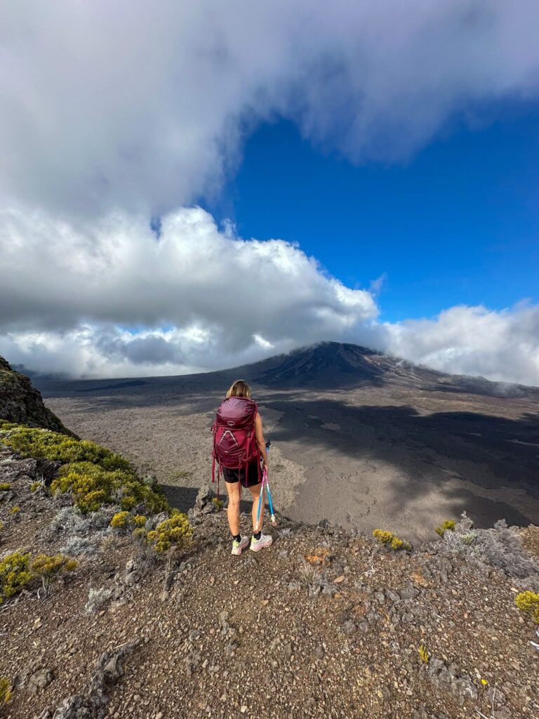
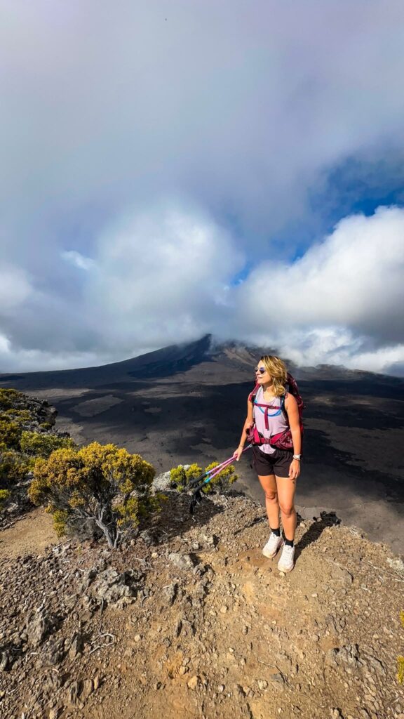
On my track there is about 1h05 between the crater rim and the floor of the enclos (from 6:55am to 8:00am). Then comes the climb back to the Pas de Bellecombe: about 145 m of ascent over 1.3 km, with the steps at the exit (Visorando describes it as fairly hard but not very long).
Is the Piton de la Fournaise hike easy or hard?
It depends what you mean by easy, so here is what my track shows. On paper, 590 m of elevation gain (according to Strava) is not huge. What matters is how it is spread: about 145 m of descent at the start, which you climb back at the end, then 230 m of ascent over 1.8 km, then nearly 5 km above 2,440 m.
On difficulty, Fournaise.info writes that the path is not dangerous in itself but that the climb is gruelling. On top of that come the altitude and, in my case, the night start.
If you would like a gentler version, Visorando suggests the Kapor trail, in the enclos. It starts from the Gîte du Volcan car park, passes the Pas de Bellecombe at 0.63 km, then goes down into the enclos. Visorando rates its distance and elevation as within reach of most people. For children and older people, Fournaise.info suggests driving to the Pas de Bellecombe to see the Bory and Dolomieu craters from the viewpoint. The same rule applies as for everything else: only if access is open.
Where to stay: why I recommend the Gîte du Volcan
For this climb we slept in a rental nearby, and with hindsight I would rather recommend the Gîte du Volcan (I also wrote gîte du Piton de la Fournaise in my GR R2 article). It is about 600 m from the entrance to the crater, according to its page on book.reunion.fr. If you stay lower down, allow 50 minutes of driving from the Plaine des Cafres before a night start.
I slept there during the traverse, on stage 2 of the GR R2. My opinion at the time: decent welcome, a slightly impersonal atmosphere, a rather good buffet. The dormitories are old but clean, with sheets provided. The bathrooms are passable. My night was only moderately restful.
Here is what the lodge’s page says. The dormitories sleep 4, 6 or 8 people, and you book by the bed: booking several does not guarantee you will have the dormitory to yourself. Breakfast, lunch and dinner must be booked 48 hours ahead, and there is no kitchen or self-service reheating. Hot water and electricity are limited because they depend on solar power, and you cannot charge your phone or your camera. Towels are not provided and animals are not allowed.
The page shows no price. My stage on the GR R2 cost me about €66 per person, with dinner, breakfast and the next day’s packed lunch. Check the price when you book. Book early too: that is the advice in the Département’s booklet, for nights as well as meals.
What to pack and how to dress
I’m going by the Département’s booklet, by Fournaise.info and by what I lived through.
- Water, food and suitable clothing.
- A torch, preferably a head torch if you set off at night, to keep your hands free.
- Survival blanket and first-aid kit.
- A power bank, and your map downloaded in advance.
- Sun cream and a cap.
- Poles if you are used to them: they are allowed on hikes and useful for balance, according to the booklet.
As for what to wear, I’m not giving you temperatures, for lack of a reliable source. What I take away from my climb: I was frozen while waiting at the crater rim. Bring a warm layer to put on as soon as you stop walking, on top of what you wear for the climb.
Walking past the Piton de la Fournaise on the GR R2
If you don’t have time to climb to the crater, you can still walk past the foot of the volcano on the GR R2. That is what we did before coming back: stage 2 of my traverse of La Réunion on foot is 20 km long, with 1,935 m of elevation gain, about 6 hours of walking to the first car park and a final effort up to the Gîte du Volcan. The next day, we picked up the path we had left the day before, crossed the Plaine des Sables, then climbed towards the Sainte-Thérèse oratory, with views of the Piton de la Fournaise.
We did not go up to the crater during the traverse: we had decided to come back a few days later. That is how this hike was born. If you are planning your stay, I have written about our holiday in La Réunion. The Piton des Neiges hike is another big outing on the island, and I have also written about the Cirque de Mafate and the Trou de Fer.
Frequently asked questions
How long does the volcano hike take?
My track lasts 6h44, including about 2 hours of stops. Among them, 33 minutes waiting for the sunrise. Komoot gives 5h01 for the round trip. Allow half a day, more if you want to wait for the sunrise.
What is the height of the Piton de la Fournaise?
The summit of the massif is at 2,632 m according to the OVPF. On the path, the crater rim is between about 2,480 and 2,500 m. My track gives 2,496 m.
What is the volcano of La Réunion called?
The island’s active volcano is the Piton de la Fournaise. According to the OVPF, it is a basaltic hotspot volcano, located in the south-east.
Can you hike the Piton de la Fournaise during an eruption?
No. Access to the enclos is forbidden by prefectoral order from alert 1, when an eruption is likely or imminent. Check the status of the day on the OVPF, prefecture and ONF sites.
Is there mobile signal around the volcano?
Not everywhere, according to Fournaise.info. Download your map before you leave. Keep 112 in mind, and the PGHM number, 02 62 930 930.
Where can you stay near the Pas de Bellecombe?
At the Gîte du Volcan, about 600 m from the entrance to the crater. You book by the bed, and animals are not allowed.
Can you go with a dog?
The Gîte du Volcan does not accept animals. Fournaise.info also advises against taking a dog: the lava crust can hurt its paws. I found no official rule about the enclos itself: ask before you go.
All my articles on Réunion Island
Here are the other articles on the island, to plan your trip or keep reading: