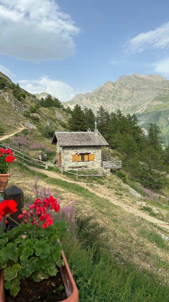
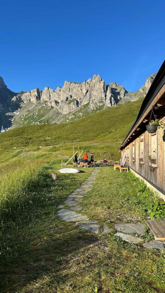
The Tour du Mont Blanc was one of my dreams, and we were lucky enough to complete it in July 2026: 8 days clockwise from Chamonix, with Cyril and his dad. On the clock: 180.5 km (112 miles), nearly 12,000 m of ascent, three countries crossed and seven completely different nights (six in refuges or gîtes, one in an Airbnb at La Fouly, more on that later). It was one of my dreams, and despite everything I’ve read and seen on social media about the TMB, the idea that there are “too many people”, I’ll say it and say it again: this tour is magnificent and deserves to be experienced. Yes, there are lots of people, but is that surprising for one of the best-known and most accessible treks in the world? And above all, there are plenty of ways to get away from the crowds and, like us, be alone on the trails 80% of the time. Anyway, I won’t dwell on it, it isn’t the heart of this article, but I thought it was important to address the question of crowds, and how I felt about it, right from the intro of this guide.
If you’re preparing your own adventure, your few days of hiking on the Tour du Mont Blanc, you’ve surely noticed that there is an enormous amount of information everywhere… from people who really did the tour, but also articles that aren’t always very good quality or very accurate. It’s not always easy to find your way around. So this guide is the one I would have loved to have in hand before leaving: verified information for summer 2027, our real figures, and what we’d do again (or not). Each section gets to the point and points you to a more detailed article if you want to dig deeper.
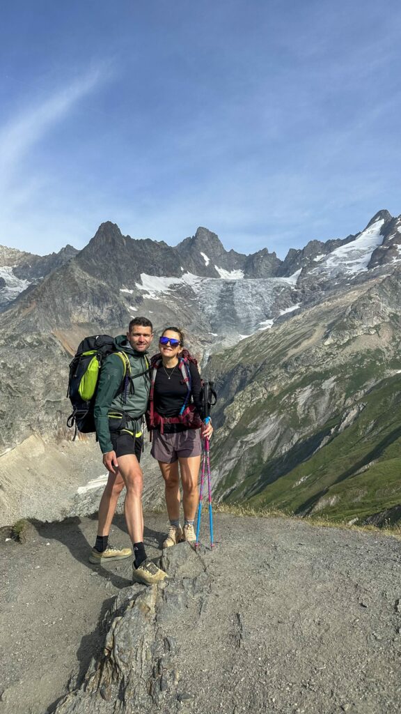
The Tour du Mont Blanc in brief
The Tour du Mont Blanc, or TMB, is a long-distance trail of about 170 km (105 miles) that circles the whole Mont Blanc massif through France, Italy and Switzerland. Here are the official figures, with ours next to them to give you an idea of the gap between theory and the trail.
| Official route | Our tour | |
|---|---|---|
| Distance | about 170 km | 180.5 km |
| Ascent | about 10,000 m | 11,995 m |
| Duration | 7 to 12 days | 8 days |
| Countries | France, Italy, Switzerland | all three |
| Start | Les Houches (the most common) | Chamonix |
| Direction | anticlockwise (the most common) | clockwise |
| Highest point | Grand Col Ferret, 2,537 m (up to 2,665 m on some variants) | night at the Refuge Robert Blanc, 2,750 m |
| Season | mid-June to mid-September | 10 to 17 July |
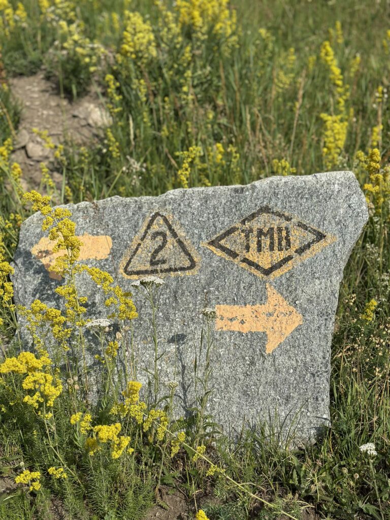
| Waymarking | white and red in France, yellow in Italy, yellow or white-red-white in Switzerland |
Why these differences, particularly in ascent and distance? Because the route has several variants, and everyone measures with their own tool. La Chamoniarde quotes 168 km, the official site “nearly 170 km”, and our 180.5 km is explained by the variants we took (the Robert Blanc first among them). Take these figures as an order of magnitude, not as gospel to the metre.
One last useful benchmark: according to the 2025 attendance data from the Espace Mont-Blanc, about two hikers out of three walk anticlockwise and nearly 8 out of 10 start from Les Houches. So we were clearly in the minority, and I tell you below what that changed for us.
Is the Tour du Mont Blanc a difficult hike?
This question is so complicated… because difficulty is personal. That said, the Tour du Mont Blanc hike isn’t technical: on the classic route there is no mountaineering section, no ropes, no glacier, no crampons in the middle of summer. It remains demanding, though: it’s mountain hiking, with the effort piling up over several days. Stringing together 1,000 to 2,000 m of climbing a day, as much descent, and starting again the next day with a pack on your back, is tough.
La Chamoniarde (the mountain prevention and rescue association in Chamonix) sums it up well: the TMB is within reach of any trained hiker who is used to varied terrain and to carrying a loaded pack. The important word is “trained”.
The sections that need a bit more attention
- The passes around 2,500 m: Col du Bonhomme and Croix du Bonhomme, Col de la Seigne (the French-Italian border), Grand Col Ferret (the Italian-Swiss border). Nothing technical, but long climbs, often windy, with conditions that change fast.
- The snowfields early in the season: until the end of June or early July, some passes can still be snow-covered. Poles, even light crampons, can then come in handy.
- The ladders of the Aiguillette d’Argentière, above Tré-le-Champ: a few metal ladders and equipped sections. If you’re afraid of heights, look at the variants in your guidebook before you leave.
- The descents, frankly the most treacherous for your knees. Poles make a real difference (I explain why in my article on the benefits of hiking poles).
Our profiles, to give you a point of reference
Cyril has run the UTMB and is a qualified mountain leader (accompagnateur en montagne), so for him the question didn’t really arise. For my part, I do quite a lot of hiking in summer, I had no particular training for this TMB and I was pretty tired from work. His dad is a regular hiker, not a competitive athlete, and he kept up the pace over the 8 days without any difficulty. Our hardest day was Day 5, towards the Refuge Robert Blanc: 29.5 km (18 miles) and 2,500 m of ascent. We chose it knowingly, but it isn’t the kind of stage to improvise.
Which duration should you choose for your hike?
Most hikers do the Tour du Mont Blanc in 7 to 10 days. Again according to the 2025 figures from the Espace Mont-Blanc, about 30% complete it in exactly 7 days, which makes it the most common format. But the right number of days depends above all on your “fitness level”, on what you’re looking for, and (we learned it the hard way) on the refuges that are still available.
| Duration | Km per day | Ascent per day | Who is it for? |
|---|---|---|---|
| 3 days | ~54 km | ~3,300 m | experienced trail runners only |
| 4 days | ~40 km | ~2,500 m | very well-trained trail runners |
| 5 days | ~32 km | ~2,000 m | fit hikers, with a bus section on the last day |
| 7 days | ~24 km | ~1,430 m | hikers in good shape |
| 8 days | ~20 to 25 km | ~1,400 m | the balance of challenge and enjoyment (our choice) |
| 10 days | ~17 km | ~1,000 m | first trek, families, a relaxed pace |
I’ve detailed each format with its stage-by-stage breakdown in my article on how many days to plan for the Tour du Mont Blanc.
If you’re hesitating, just remember this: don’t overestimate your legs. 25 km (15 miles) looks reasonable on paper. With 1,800 m of climbing and 9 kg on your back, it’s another story.
Our Tour du Mont Blanc itinerary in 8 days
Here is our real route, day by day, clockwise from Chamonix. The stages don’t look like the classic breakdowns you’ll find elsewhere, which is normal: we were walking against the flow, we took a few variants to see beautiful places, and the available beds shaped some of our route choices.
| Day | From → to | Distance | Ascent / descent |
|---|---|---|---|
| Day 1 | Chamonix → Les Écuries de Charamillon | 20 km | +2,000 m / -1,160 m |
| Day 2 | Charamillon → Bon Abri (Champex-Lac) | 21 km | +1,250 m / -1,620 m |
| Day 3 | Champex → La Fouly | 20 km | +870 m / -600 m |
| Day 4 | La Fouly → Rifugio Bertone | 25 km | +1,570 m / -1,280 m |
| Day 5 | Bertone → Refuge Robert Blanc | 29.5 km | +2,500 m / -1,700 m |
| Day 6 | Robert Blanc → Refuge des Prés | 20 km | +1,095 m / -1,900 m |
| Day 7 | Les Prés → Refuge du Fioux | 24 km | +1,350 m / -1,760 m |
| Day 8 | Fioux → Chamonix, via the Col de Voza | 21 km | +1,360 m / -1,870 m |
| Total | 180.5 km (112 miles) | +11,995 m / -11,890 m |
The variants we took
Three detours explain our extra 10 km and 2,000 m of ascent compared with the official route:
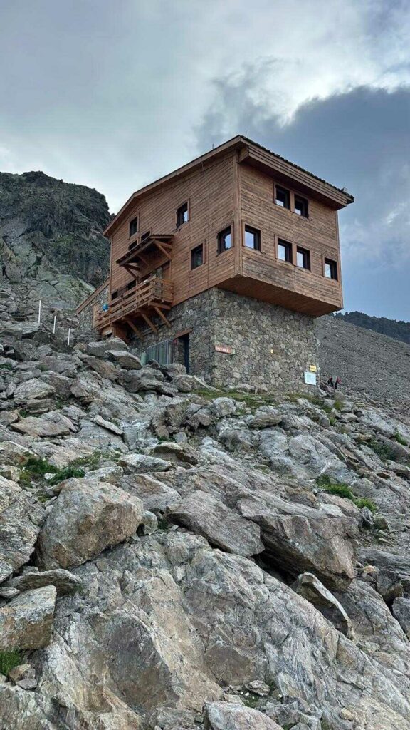
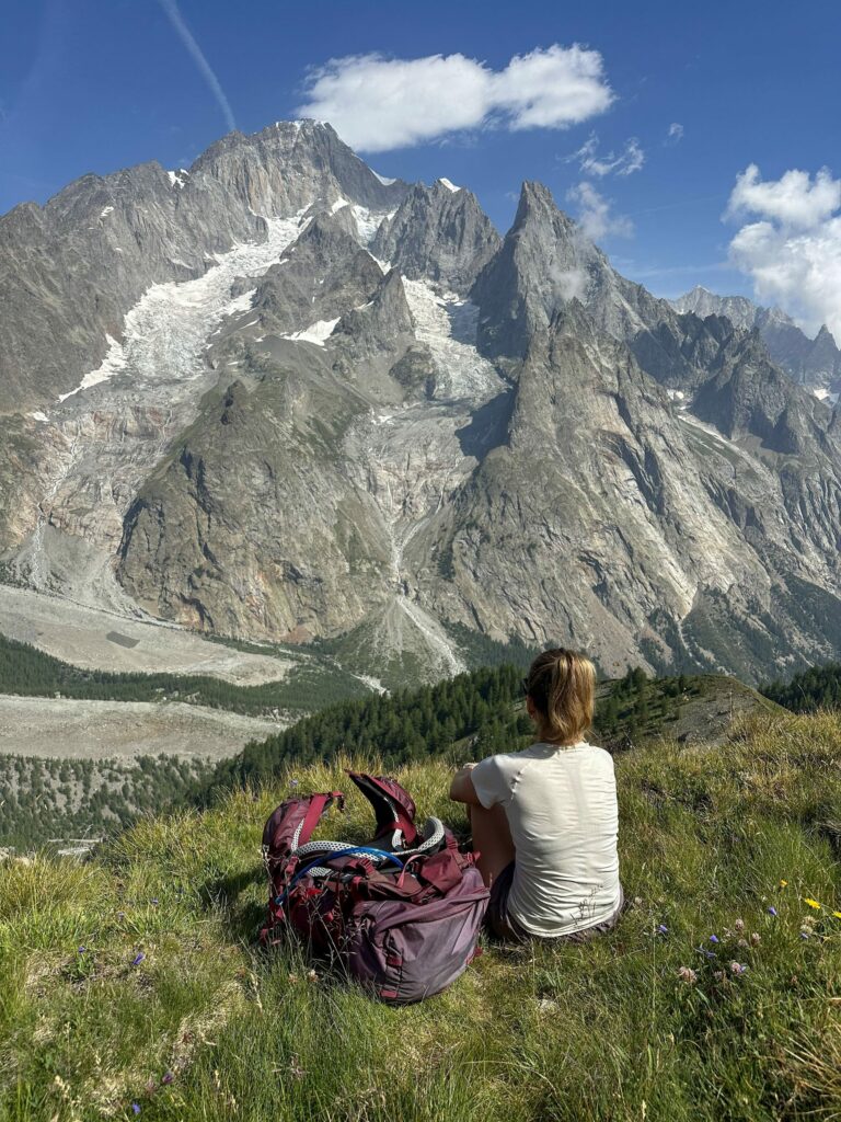
- The Refuge Robert Blanc, perched at 2,750 m above the Vallée des Glaciers. It isn’t on the main route, and I’d only recommend this detour to experienced hikers. It’s our biggest day and, despite the difficulty, it’s also my best memory of the tour.
- The Lac Blanc, in the Aiguilles Rouges reserve, a very busy variant but one that’s worth the detour.
- The Col du Tricot and the Miage chalets, on the Bionnassay side, which add ascent compared with the classic route via the Col de Voza.
Our full route is on an interactive map, with the GPX file to download, in my article on the Tour du Mont Blanc map.
How we handled it in practice
- Bookings: we booked everything several months ahead, and several refuges were already showing full. That’s what took us from 7 to 8 days.
- Luggage: we carried our own packs, around 9 kg each. In any case, Bertone and Robert Blanc can’t be reached by car, so no carrier could have followed us there.
- Payment: Bertone only takes cash, and the Fioux doesn’t take contactless. Bring cash in euros and Swiss francs, as cash machines are only in the valleys.
Which direction should you do the Tour du Mont Blanc in?
The classic direction is anticlockwise from Les Houches: France, then Italy, then Switzerland. That’s the direction of the vast majority of hikers and of almost every guidebook. But nothing stops you going the other way round, as we did.
| Anticlockwise (classic) | Clockwise (our choice) | |
|---|---|---|
| Order of countries | France, Italy, Switzerland | France, Switzerland, Italy |
| Guidebooks and tracks | written for this direction | to be read backwards |
| On the trail | you walk with the flow | you meet more people than you follow |
| Walking times | those in the guidebooks | to be recalculated, as climbs and descents are reversed |
What we liked about clockwise: we saw lots of viewpoints head-on, and we met other hikers rather than following them. As I said in the intro, we were therefore alone about three quarters of the time: we set off alone in the morning and suddenly, after 2 to 3 hours of walking, we’d meet all the hikers of the day… then nothing again. Which also lets me say that if you walk anticlockwise, it’s sometimes enough to start a little off-peak to have far fewer people around. It makes sense: the feeling of “wow, there are so many people” is also explained by the fact that the flows are concentrated. People all leave the refuges at the same time, after breakfast and so on, so they end up doing the big climbs at the same time, stopping at the key points at the same time, and so on. Having walked the whole tour against the flow, it’s obvious.
What takes more work with clockwise: the guidebook is designed for the other direction, so you have to cross-check with your own track and redo your time estimates. I make the job a bit easier with my articles, of course.
What can be a shame, and is worth noting: since most people walk anticlockwise, they keep bumping into each other and can gradually form bonds. We were going against the flow, so we met nice people but the next day we were going the opposite way… it’s worth considering depending on whether you want to make friends, for example. We were also completely “the other way round” from the collective mood: on our first night at Charamillon, for example, we arrived fresh, on day one, the day we were finding our feet, whereas the people in the refuge with us were in the last-day mood: relax, only one stage left, let’s have a bit of a party and order jugs of wine. In short, you’ve understood: you’re against the flow during the day and in the evening too.
For a first TMB, anticlockwise remains the easiest to organise. If you’re comfortable with a map and you want to get off the stages everyone does, clockwise is a very good option.
Where to sleep on the Tour du Mont Blanc?
In refuges or gîtes, on half board, and booked long in advance. For summer 2027, bookings for the refuges and gîtes that are members of the TMB association open on 15 October 2026 on montourdumontblanc.com, and the most popular ones go within a few days.
Half board includes the night in a dormitory, dinner and breakfast. The official platform quotes about 65 to 95 € a night in a dormitory. Our own nights ranged from 45 € (Refuge du Fioux) to 70 € (Rifugio Bertone), and in Switzerland you often pay in francs (at Bon Abri, 34 to 44 CHF for the bed plus 25 CHF for dinner and 12 CHF for breakfast).
What to know before booking
- Three booking channels: the centralised platform for association members, forms or emails for some refuges (the Bonatti and the Elisabetta in particular), and the own websites of a few others. It takes a bit of organisation.
- Start with the small refuges and those where you have no fallback. The Rifugio Elena has only about forty places. If one link drops out, your whole breakdown falls apart.
- The sleeping bag liner is compulsory in all refuges. Blankets and pillows are provided, so there’s no need for a sleeping bag.
- The times are strict: at the Fioux, arrival between 3 pm and 6.30 pm and departure before 8.15 am.
- Remember cash: several refuges don’t take cards.
We tested seven completely different nights, from a former barn for Hérens cows to a high-altitude refuge without showers at 2,750 m. Prices, atmosphere, meals and our honest opinion on each one: it’s all in my article on the Tour du Mont Blanc refuges.
Can you bivouac on the Tour du Mont Blanc?
Only partly, and less and less freely. We did everything in refuges, but here is the state of the rules in 2026, country by country.
| Country | Rule | What it means on the TMB |
|---|---|---|
| France | tolerated, but regulated reserve by reserve and commune by commune | forbidden below 2,500 m in the Contamines-Montjoie reserve from 15 June to 15 September, except at the Rollaz and Balme areas (by reservation); forbidden in the Vallée des Glaciers, except the Chapieux area; in the Aiguilles Rouges, from 7 pm to 9 am in designated, reserved zones, and forbidden around the Lac Blanc; bivouac and camping forbidden in the commune of Chamonix, apart from high-altitude bivouac |
| Italy | tolerated above 2,500 m only | almost the whole Italian side of the TMB is below that, so refuge, campsite or Courmayeur |
| Switzerland | forbidden, with rare exceptions | campsites at La Fouly, Champex or Trient |
Reservations for the bivouac zones in Haute-Savoie are made on reserve-bivouac74.fr, and pitching outside the authorised zones or hours exposes you to a fine of 68 €. Be careful, these rules depend on prefectural orders that are renewed every year: check the ones for your year before you leave.
Practical conclusion: even if you set off with a tent, you’ll have to book refuges for the whole Italian and Swiss crossing. And frankly, without a tent, sleeping bag or stove, the pack stays much lighter: we were around 9 kg each.
What’s announced for 2027
The rules are going to tighten on the French side. In mid-September 2026, the communes crossed by the TMB in France (Vallorcine, Chamonix, Les Houches, Saint-Gervais, Les Contamines-Montjoie, Beaufort and Bourg-Saint-Maurice) agreed with the refuge keepers, guides and carriers on the principles of a common charter. Implementation is aimed for spring 2027.
What is planned, at this stage:
- compulsory booking of your accommodation in summer to do the tour as a multi-day trek on the French section;
- the end of wild bivouac, in favour of paid bivouac areas that require booking;
- regulated luggage transport, limited to trek bags (no more suitcases);
- checks on the trail.
Two important points. The charter was still being finalised at the end of September 2026, so the details may change. And a walk of a few hours on a section of the TMB isn’t affected. I’ll update this section as soon as the final text is published.
Hiking the Tour du Mont Blanc without a guide: waymarking and navigation
Yes, it’s perfectly doable and frankly I’d say 90% of the people we met didn’t have a guide. But many international groups opt for one, and having a guide also has plenty of advantages, in terms of safety but also knowledge of the terrain. The TMB is a long-distance trail that is maintained and waymarked from end to end, with no technical sections on the classic route.
That said, it remains a mountain hike, with weather risks always present. If you decide to do it alone or with others but without a qualified person, it’s essential to learn the basics of safety (how to behave in a storm, with an injury, and so on).
The waymarking changes colour depending on the country, and it’s the only thing to remember before you leave:
- in France, white and red, the GR code;
- in Italy, yellow;
- in Switzerland, yellow on the easy paths, white-red-white on the more committing sections.
Our method, which we followed as three with no agency and no guide (honestly, Cyril is a mountain leader and already knew the route, which helps):
- the official FFRandonnée topoguide to the GR TMB (ref. 028, 18.40 €) in the pack, which we leafed through in the evening to anticipate the next day’s stage;
- our own GPX tracks, downloaded offline in an app such as Cartes IGN, to see our position in real time in fog or at an unclear junction;
- the physical waymarking, as a permanent complement.
Before you leave, also save the emergency numbers: 112 in France and Italy, 144 in Switzerland (Valais).
How to find your way, which apps to use, and the comparison between full self-reliance, a self-guided package and travelling with a guide: I go through it all in my article on hiking the Tour du Mont Blanc without a guide.
How much does the Tour du Mont Blanc cost?
The trail is free, but the TMB isn’t a cheap trek: half-board accommodation accounts for most of the bill. For a package of around 7 nights, here are the real ranges for the three ways of doing it.
| Option | What’s included | Budget per person |
|---|---|---|
| Fully independent | you book and navigate on your own | 600 to 1,200 €, excluding transport |
| Self-guided | via an agency: refuges booked, roadbook and track provided, you walk on your own | 960 to 1,215 € |
| Accompanied by a guide | a qualified mountain leader walks with the group | 1,010 to 1,475 € and more |
To do your own calculation, the items to add up are: half board (about 65 to 95 € a night depending on the night, often more in Switzerland), the packed lunch prepared by the refuge (12 to 14 €, to be ordered the day before), drinks, the paid showers in some refuges, the return transport, and insurance that covers mountain rescue costs.
For our part, over 8 days, we spent between 600 and 800 € per person on nights and food, excluding transport. The detail of prices, refuge by refuge, is in the refuges article mentioned above.
When to do the Tour du Mont Blanc?
Between mid-June and mid-September, the period when the refuges are staffed. Within this window, each month has its advantages and its pitfalls.
| Period | Conditions | Crowds |
|---|---|---|
| Mid-June to early July | snowfields possible on the passes, poles and sometimes light crampons useful | quieter |
| 14 July to 15 August | trails clear, frequent afternoon storms | at their peak, some refuges full |
| Late August to mid-September | often stable weather, cooler nights | quieter, except the week of the UTMB races in late August |
| After about 20 September | most refuges close, to be checked one by one | low |
We set off from 10 to 17 July, right in the busy period. A tip from La Chamoniarde: guided groups often start on a Saturday or Sunday, so setting off midweek already helps you avoid a good part of the flow.
And whatever the date, check the opening and closing dates of each refuge on your route: the Robert Blanc, for example, is only staffed from early June to 15 September.
How to get to the start of the Tour du Mont Blanc?
The classic start is at Les Houches, next to Chamonix, but it’s a loop: you can begin wherever you like, at Chamonix like us, Les Contamines, Courmayeur or Champex.
- By train: head for Saint-Gervais-les-Bains-Le Fayet station, then take the Mont-Blanc Express to Les Houches or Chamonix. If you sleep in the valley before or after the tour, ask your accommodation for the guest card, which gives free access to the trains of the Chamonix valley.
- By plane: Geneva airport is the closest, with regular buses and shuttles to Chamonix in a little over an hour.
- By car: car parks near the Les Houches lifts, or the guarded car parks in Chamonix with a weekly rate, then an urban bus to the start.
Good to know if you have to cut your trip short: at each valley bottom (Les Contamines, Les Chapieux, Courmayeur, La Fouly, Champex), you can return to Chamonix by public transport. At the Col de la Forclaz, a postal bus takes you to Le Châtelard station, then on to the Chamonix valley.
Pack, boots and gear
In refuges, a 35 to 45 litre pack is enough, and the aim is to stay around 8 to 10 kg including water and the day’s packed lunch. We were around 9 kg each, on half board everywhere so we carried no food in the evening, with just the essentials in clothing (everything dries in the evening at the refuge).
The essentials, the ones people forget most often:
- the sleeping bag liner, compulsory in all refuges;
- cash in euros and Swiss francs;
- an ID document, since you cross three borders;
- earplugs (in a dormitory of 16, there’s always a snorer);
- a head torch, a waterproof jacket and a warm layer, even in July;
- poles, for the descents;
- sunglasses and sun cream, as the exposure is strong at altitude.
And above all, your feet. Whatever the duration, they’re what will make or break your tour: boots that are broken in before departure, tried out on real outings with ascent, and merino socks. I explain how to choose in my article on how to choose hiking boots. And so that you don’t end Day 3 in pieces, I’ve also gathered my routines for recovering after a hike.
Tour du Mont Blanc: the FAQ
How many kilometres is the Tour du Mont Blanc?
About 170 km (105 miles) with about 10,000 m of ascent, according to the official site. Variants can lengthen the whole thing: we did 180.5 km and 11,995 m of ascent.
When should you do the Tour du Mont Blanc?
Between mid-June and mid-September, when the refuges are staffed. If you can, avoid the period from 14 July to 15 August, the busiest, and think about snowfields at the very start of the season.
How much does the Tour du Mont Blanc cost?
Fully independent, count about 750 to 1,200 € per person for 7 nights, excluding transport. With an agency, from 960 € for a self-guided package to more than 1,000 € with a guide.
Do you need to book the refuges?
Yes. For summer 2027, bookings open on 15 October 2026 on montourdumontblanc.com, and compulsory booking for multi-day trekking on the French side is announced from 2027.
Can you do the Tour du Mont Blanc with a dog?
Not on the whole classic route. Dogs are forbidden in the Aiguilles Rouges and Carlaveyron reserves, and tolerated on a lead in the Contamines reserve, in Italy and in Switzerland. That’s why our dog Rhéa stayed at home.
Can you have your luggage transported?
Yes, taxis carry bags from refuge to refuge, as long as the refuge can be reached by car (which isn’t the case for the Croix du Bonhomme, the Elisabetta, Bertone or the Bonatti). From 2027, transport is expected to be limited to trek bags.
Can you do the TMB in two parts?
Yes. La Chamoniarde suggests, for example, splitting it into two half-tours over two summers: Les Houches to Courmayeur, then Courmayeur to Les Houches.
There you go, you have all the cards in hand. If I had to sum up the Tour du Mont Blanc in one sentence: it’s not a feat reserved for athletes, but it isn’t a stroll either. Choose your duration, book your refuges as soon as bookings open, prepare your navigation, and train a little with a pack on your back. The mountain takes care of the rest.
We did it in 8 days, we loved it, and I already want to go back. If you’re preparing your own TMB, tell me in the comments or on Instagram which direction and which duration you choose, I always reply.