Are you looking for a quieter route that is just as rich, to start walking the Camino de Santiago? The Via Tolosana, also called the Voie d’Arles, may be what you need. It is one of the four great historic routes of the Camino de Santiago in France. It is also one of the least known. Yet it crosses beautiful landscapes in the south of France, from Provence to the foothills of the Pyrenees. It goes via Montpellier, Toulouse and Auch, up to the junction with the Spanish routes.
I was lucky enough to walk two sections of the Voie d’Arles. The first was in 2011 between Arles and Lodève. The second was in 2023 between Montpellier and Toulouse. They were two very different experiences, but each time I had the same impression. Here you really walk for yourself, far from the crowds, immersed in beautiful rural territories that are sometimes wild and often unexpected.
So if you are wondering whether the Via Tolosana is right for you, you are in the right place. This guide explains what it crosses, how to prepare and what to expect in terms of difficulty, accommodation and landscapes. I will talk about this route based on what I lived, without overselling it. I will also show you why, in my eyes, it truly deserves a closer look.
The Via Tolosana in short
If you want the essentials before you read on, here they are.
- Route: from Arles to the Somport pass in France, then the Camino Aragonés in Spain up to Puente la Reina. There it joins the Camino Francés.
- Waymarking: the GR® 653, generally reliable, with a few more uncertain areas around big towns.
- Length: about 1,590 km in total, with stages of 20 to 25 km a day on average.
- Time needed: between 30 and 40 days for the French part, depending on your pace.
- Best season: spring, from April to June, or September and October with more uncertain weather near the Pyrenees.
- Accommodation: fewer places than on the Via Podiensis, but enough. Book ahead in May, June and September.
The Camino de Santiago routes: several ways to the same goal
One of the great strengths of the Camino de Santiago is that there is no single starting point. Historically, several French routes were used by pilgrims to reach Spain. And even today, this variety lets everyone build their own route according to the time available, their wishes or where they live.
There are four main routes in France, called the “voies jacquaires” (the Way of St James routes):
- Via Turonensis, from Paris or Tours
- Via Lemovicensis, from Vézelay
- The Via Podiensis, the best known, from Le Puy-en-Velay;
- The Via Tolosana, also called the Voie d’Arles, from Arles towards Toulouse and then the Somport pass.
Each of these routes offers a different atmosphere and different landscapes. You can set off from your own front door, as the original pilgrims did, or choose an emblematic starting point. It all depends on the time you have. You do not set off on two months of walking just like that unless you are retired or on a sabbatical. Many people split their pilgrimage into several sections, year after year.
The Voie d’Arles is less busy than the Via Podiensis. It is also wilder, more southern and often more physically demanding. This makes it ideal if you want a less touristy route that is still rich in encounters, heritage and nature. It is also a good way to discover other sides of the south of France before crossing the Spanish border.
Find more information on the Camino de Santiago routes in Spain: the Camino del Norte, the Camino Primitivo and the Camino Francés.

The Via Tolosana or Voie d’Arles: what exactly is it?
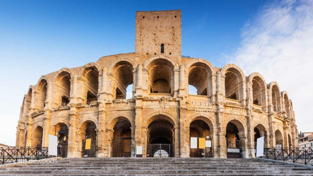
The Via Tolosana, more commonly called the Voie d’Arles, is one of the four great historic routes of the Camino de Santiago in France. It follows the GR® 653, a well-marked long-distance footpath linking Arles, in Provence, to Puente la Reina, in Spain, where it joins the Camino Francés. It is the southernmost of the French Way of St James routes. The route crosses a wide variety of landscapes, cultures and climates in the south of France, up to the Pyrenees.
Historically, the Via Tolosana was used by pilgrims coming from Italy or Rome to reach Santiago de Compostela. It was then known as the “Via Aegidiana” or “Via Arelatensis”, in connection with the city of Arles and the tradition of medieval pilgrimages. You will no longer see these names on waymarks today, but it is still the same route that you follow.
The route officially starts in Arles and crosses the Pyrenees by the Somport pass, a lesser-known alternative to the very busy Roncesvalles pass. Once in Spain, the path becomes the Camino Aragonés, a magnificent route through mountain landscapes before it joins the other routes at Puente la Reina. From there, all pilgrims converge on the Camino Francés towards Santiago de Compostela.
Length and towns crossed
The Voie d’Arles is about 1,590 km in total:
- About 740 km between Arles and the Somport pass, on the French side
- Then about 850 km from the Spanish border to Compostela, following the classic Spanish routes
This route crosses varied territories rich in heritage: Provence, Languedoc, Lauragais, Comminges, Béarn… It passes through many emblematic towns and villages such as Saint-Guilhem-le-Désert, Lodève, Castres, Toulouse, Auch, Pau, Oloron-Sainte-Marie and Urdos. Each of these stages marks the route with its history, its beauty and its authenticity.
UNESCO World Heritage monuments on the route
Among the major monuments listed as UNESCO World Heritage under the Camino de Santiago routes in France, you will find:
- The town of Arles
- Saint-Sernin basilica and the Hôtel-Dieu Saint-Jacques in Toulouse
- Sainte-Marie cathedral in Auch
- Sainte-Marie church in Oloron-Sainte-Marie
So it is a route that is historic, cultural and natural all at once. It is less busy than other routes such as the Via Podiensis, but no less rich. It is a good alternative if you want to get away from the crowds and live a wilder, more reflective pilgrimage. On the accommodation side, it is a little less well served than some of the more touristy routes. Still, it is perfectly possible to walk without too many constraints if you plan your route a little ahead.

Why choose the Voie d’Arles to start the Camino de Santiago?
If you are still hesitating between several routes to start the Camino de Santiago, let me explain why the Via Tolosana, or Voie d’Arles, truly deserves your consideration. I chose this route twice myself. I can tell you it offers a change of scenery that is accessible and much quieter than some of the busier routes.
A well-served route with flexible logistics
Let’s be honest: when you only have two weeks of holiday and you have to juggle train timetables, practicality matters. That is exactly what made me decide to come back and walk the Voie d’Arles. In 2011, I walked from Arles to Lodève. And in 2023, I continued between Montpellier and Toulouse. These are two big cities that are well connected, with stations and simple links. Arles is also easy to reach by train from Paris, Lyon or Marseille.
The Voie d’Arles crosses many medium-sized and large towns, which also makes planning easier if you walk the route in several stages over time. In addition, some sections let you walk for just a week while still getting a real feel for the variety of the route.

A calmer and more authentic atmosphere than on the classic routes
Unlike the Via Podiensis (the route from Le Puy-en-Velay), the Voie d’Arles is still relatively little known. And that changes everything! There are fewer people on the path, fewer crowded hostels, and a calmer, more reflective atmosphere. You meet fewer pilgrims, of course, but the ones you meet are often there for the same reasons as you. They come to reconnect, to take their time, to get away from the bustle of everyday life. I particularly liked this more discreet, less “touristy” side of the route.
Landscapes that change almost every day
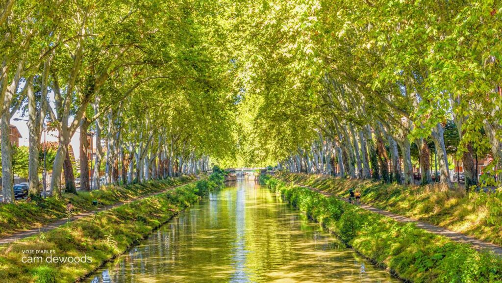
What struck me every time I walked the Voie d’Arles is the incredible variety of landscapes. You go from the garrigue scrubland of Languedoc to the forests of the Hérault, from hilltop villages to the plains of the Lauragais. You also cross the canal du Midi and reach the first Pyrenean foothills. Honestly, there is no time to get bored. Every day the scenery changes, and you rediscover the urge to keep going just to see what lies beyond the next hill.
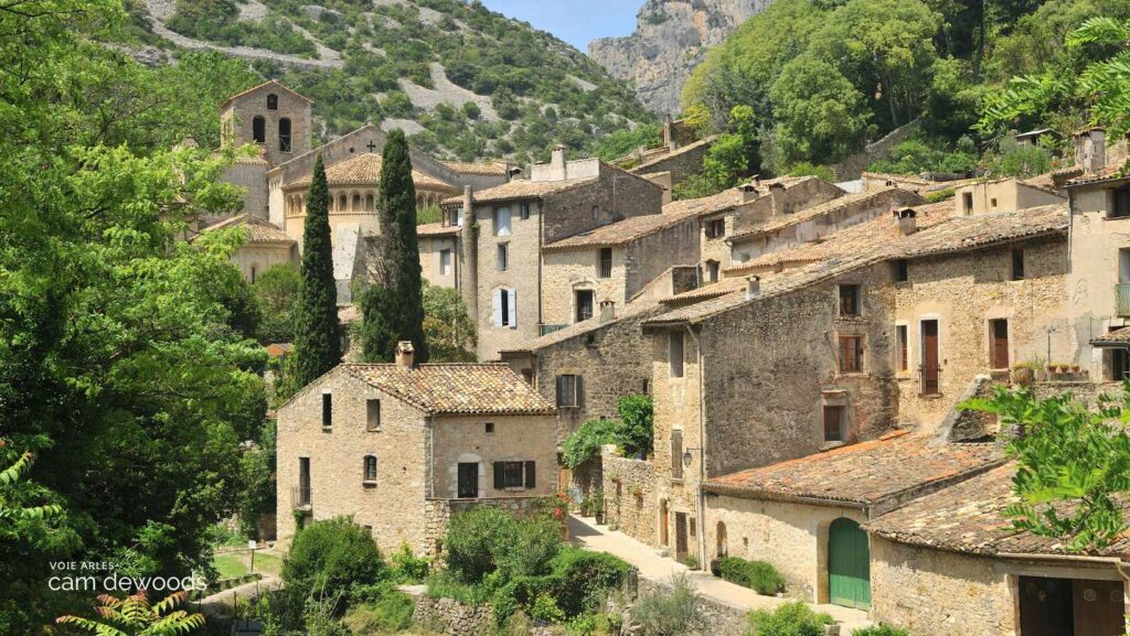
Some sections are truly unforgettable, like the one at Saint-Guilhem-le-Désert, a real favourite of mine. Walking back into this listed village, after discovering it six years earlier, was a strong moment. But it is not the only one. Castanet-le-Haut, Sorèze, Castres and the lively lanes of Toulouse are all stages worth the detour. And often, it is the lesser-known little villages that leave you with the best memories.

Waymarking that is generally reliable (and a few surprises)
I never choose a route based on its waymarking, but I admit it is a real plus when it is well done. On the Voie d’Arles, overall, the GR 653 waymarking is pretty well done. You follow the red and white marks fairly easily, without having to get your guidebook out every ten minutes. Of course, a few sections are less obvious, especially as you approach certain villages, but nothing dramatic.
And at worst, you ask the way. On this less-travelled route, local people are often delighted to see pilgrims go by. It is one of the charms of the path: the encounters, the conversations, the tips picked up at the side of a trail.
The Voie d’Arles (or Via Tolosana) is a route that is authentic, accessible, varied and rich in discoveries. If you are looking for a quieter path that is just as powerful as the great classics, it clearly deserves a place on your list.
How difficult is the Voie d’Arles?
The Voie d’Arles is one of the longest routes to reach Santiago de Compostela from France. And naturally, long distance means managing your effort over the long term. But there is good news. Even if the route can be impressive for its total length, it remains accessible with good preparation, a bit of flexibility… and plenty of motivation!
A fairly demanding Camino route, but not insurmountable
The climbing on the Voie d’Arles is relatively moderate overall, especially if you compare it with routes such as the Camino Primitivo in Spain. There are a few more physical sections, particularly when crossing the Haut-Languedoc or on the climb to the Somport pass, on the Franco-Spanish border. But most of the time, you progress on pretty paths, small country roads or along the canal du Midi.
On average, stages are between 20 and 25 kilometres a day, which is fairly standard for the Camino. Of course, this split can (and should!) be adjusted to your pace, your walking experience and the accommodation available. Some days, accommodation is more spread out, which sometimes means slightly long stages. But with a little planning, and by relying on guidebooks or apps like Buen Camino or Miam Miam Dodo, you can always find a suitable organisation.
Accessibility that depends on your fitness and your equipment
The Voie d’Arles requires a certain endurance, especially if you decide to walk several weeks in a row. It is not necessarily the route I would recommend first to a complete beginner, unless they take the time to prepare physically. That is all the more true because some stages cross fairly isolated areas, with few places to buy food or find water. This calls for a little more self-sufficiency than elsewhere.
But if you are already used to walking, you are well equipped and you know how to listen to your body, this path is for you. It offers a good balance of reasonable physical challenge and contemplative moments. And all with fewer people than on other French routes such as the Via Podiensis, which lets you walk in a calmer, more reflective atmosphere.
Voie d’Arles accommodation: where to sleep on the Via Tolosana
One of the most crucial subjects when you plan your route on the Camino de Santiago is of course accommodation. On the Voie d’Arles, or Via Tolosana, the question comes up often: where do you sleep? Are there as many hostels as on the Le Puy route? Do you need to book ahead? Is it harder out of season? Here is a full overview to help you see more clearly.
Fewer places to stay, but more than enough
Let’s be clear from the start. The Voie d’Arles has fewer places to stay than the Via Podiensis (the Le Puy-en-Velay route) or the Camino Francés in Spain. But that does not mean you will sleep under the stars every night!
There is a good variety of accommodation on the Via Tolosana, as long as you plan ahead and prepare your route a little. You will find:
- Gîtes d’étape and pilgrim hostels (run by associations or privately)
- Municipal hostels, especially in big towns or very popular places
- Guesthouses and small hotels, sometimes at pilgrim prices
- A few campsites open in season
You can also sometimes enjoy hospitality in private homes, notably through networks like Accueil Jacquaire or thanks to local initiatives.
Book or not?
It all depends on the season. In May, June and September, the route is busier. I advise you to book some accommodation in advance, especially in villages where the choice is limited. Outside these periods, you can often improvise from one day to the next, but it is always useful to have a few addresses marked.
Personally, during our trek between Montpellier and Toulouse, we alternated booking in advance (especially the first days) and improvising depending on the day’s tiredness. There was no major problem to report, but it does take a little organisation.
Tip: always get into the habit of calling or sending a message the day before to make sure a bed is waiting for you. This matters especially if you arrive late.
A few useful resources
- Miam Miam Dodo Via Tolosana: the essential guide that lists a large part of the accommodation with contact details, prices and facilities
- Camino websites: many associations keep reliable accommodation lists up to date
- Facebook groups and pilgrim forums: you will often find very concrete feedback there
In short, while the Voie d’Arles does not have a place to stay every 5 kilometres like some of the more touristy routes, it is perfectly doable, as long as you have a map, a few landmarks and a bit of flexibility. And in the end, sleeping in places that are sometimes more intimate or slightly off the path is part of the charm of this beautiful route.
Find my article on accommodation on the Camino de Santiago.
The Via Tolosana route: stages from Arles to Puente la Reina
If you are thinking of walking the Via Tolosana, it is essential to have a clear idea of how the route can be split. As always on the Camino de Santiago, this split is indicative: some people prefer to walk longer each day, others less. What matters is to move forward at your own pace.
To understand this subject better, see my article: how many miles a day on the Camino de Santiago.
To help you picture it, here is a typical split of the stages of the Voie d’Arles, based on a coherent and balanced progression.
Total distance: about 770 km to the Somport pass, then a further 850 km on the Camino Francés to reach Santiago de Compostela.
Average duration: between 30 and 40 days for the French part, depending on your walking pace.
Here is an example of how to split the Camino de Santiago via the Voie d’Arles, from Arles to Puente la Reina, the junction with the Camino Francés in Spain:
From Arles to Toulouse: crossing the Mediterranean south
Stage 1: Arles to Saint-Gilles-du-Gard: 20.5 km
Stage 2: Saint-Gilles-du-Gard to Vauvert: 17 km
Stage 3: Vauvert to Gallargues-le-Montueux: 13.5 km
Stage 4: Gallargues-le-Montueux to Montpellier: 36 km
Stage 5: Montpellier to Montarnaud: 23 km
Stage 5: Montarnaud to Saint-Guilhem-le-Désert: 22 km
Stage 6: St-Guilhem-le-Désert to St-Jean-de-la-Blaquière: 24 km
Stage 7: Saint-Jean-de-la-Blaquière to Soumont and Lodève: 15 km
Stage 8: Lodève to Lunas: 28 km
Stage 9: Lunas to Saint-Gervais-sur-Mare: 28.5 km
Stage 10: St-Gervais-sur-Mare to Murat-sur-Vèbre: 23 km
Stage 11: Murat-sur-Vèbre to La Salvetat-sur-Agout: 22 km
Stage 12: La Salvetat-sur-Agout to Anglès: 20.5 km
Stage 13: Anglès to Boissezon: 21 km
Stage 14: Boissezon to Castres: 16 km
Stage 15: Castres to Dourgne: 22 km
Stage 16: Dourgne to Revel: 19 km
Stage 17: Revel to Les Cassès: 17 km
Stage 18: Les Cassès to Montferrand: 22 km
Stage 19: Montferrand to Baziège: 25 km
Stage 20: Baziège to Toulouse: 34 km
From Toulouse to the Somport pass: between Gascon lands and the Pyrenees
Stage 21: Toulouse to Léguevin: 23
Stage 22: Léguevin to L’Isle-Jourdain: 14.5
Stage 23: L’Isle-Jourdain to L’Isle-Arné / La Motte: 33 km
Stage 24: L’Isle-Arné / La Motte to Auch: 26.5 km
Stage 25: Auch to Barran: 17 km
Stage 26: Barran to Montesquiou: 15 km
Stage 27: Montesquiou to Marciac: 24 km
Stage 28: Marciac to Maubourguet: 17 km
Stage 29: Maubourguet to Anoye: 23.5 km
Stage 30: Anoye to Morlaàs: 15 km
Stage 31: Morlaàs to Lescar: 20 km
Stage 32: Lescar to Oloron-Sainte-Marie: 33 km
Stage 33: Oloron-Sainte-Marie to Sarrance: 22 km
Stage 34: Sarrance to Borce: 22 km
Stage 35: Borce to the Somport pass: 18 km (total = 768.5 km)
In Spain: on the Camino Aragonés, up to Puente la Reina
Stage 36: Somport pass to Jaca: 22 km
Stage 37: Jaca to Arrès: 25 km
Stage 38, Voie d’Arles: Arrès to Ruesta: 27
Stage 39, Voie d’Arles: Ruesta to Sanguesa: 23
Stage 40, Voie d’Arles: Sanguesa to Monreal: 31.5 km
Stage 41, Voie d’Arles: Monreal to Puente la Reina: 31.5 km
Good to know: once you arrive at Puente la Reina, you join the Camino Francés. You can find my full article on the Camino Francés here.
You will notice that some stages are long (30 km or more), especially in rural areas with fewer places to stay. If that is too much for you, do not hesitate to plan intermediate splits or longer breaks. There are sometimes alternatives or local transport that let you adjust your route.
Elevation profile of the Voie d’Arles
Elevation profile of the Voie d’Arles on the Camino de Santiago (PDF, in French)

When to walk the Via Tolosana?
When you prepare to set off on the Camino de Santiago, the time of year you choose plays a huge part in your overall experience. The Via Tolosana, also called the Voie d’Arles, is no exception. To walk with peace of mind and avoid the biggest heat or endless rain, it is better to set off at the right time.
What is the best season to walk the Voie d’Arles?
For my part, I walked different sections of the Via Tolosana in spring. In my view, it is the ideal period for this route, especially if you start from the south of France. From April to June, you enjoy pleasant temperatures (neither too hot nor too cold), very green landscapes and, above all, fewer people. Summer can be very hot, especially in the first part between Arles and Lodève, where the sun beats down and shade is rare.
Autumn can also be a good option (September to October), but be careful, as the weather becomes more uncertain as you approach the Pyrenees. In winter, some parts can be wet, even snowy in the high ground. It is not impossible, but it takes real preparation.
Practical tips to prepare your departure on the Voie d’Arles
The right equipment for the Via Tolosana
The equipment you need on the Voie d’Arles is similar to that for any long pilgrimage, but with a few specific points. As I experienced myself, days can be long and hot, so be sure to pack:
- A cap or a wide-brimmed hat (the sun is strong!)
- Light waterproof jacket: some sections are wooded and cool in the morning
- A light backpack, between 35 and 45 litres, with enough water
- Well broken-in shoes suited to long-distance hiking, as some sections are stony
And of course, do not forget the classics: a first-aid kit, a head torch, a phone charger, earplugs and at least two pairs of good socks! I also advise you to plan your water points ahead, as some days are a little more isolated.
You can find more tips in my article on equipment for the Camino de Santiago.
Waymarking and signage
Good news: the Via Tolosana is waymarked, mainly thanks to the GR 653. Overall, the waymarking is good quality, but there are a few more uncertain areas, especially around big towns where the layouts change often. In rural areas it remains fairly reliable, but I strongly advise you to have a digital aid in case of doubt.
Useful apps for your walk
Here are the apps I used and that I recommend for the Via Tolosana:
- Miam Miam Dodo (digital version) or Camino Ninja: very good for splitting stages and finding accommodation
- Maps.me: for the sections where there is no waymarking
- Wise Pilgrim: although it is better known for the Camino Francés, it also covers this route
- Visorando or Outdooractive: to record your GPS tracks or follow an interactive map in real time
Via Tolosana: frequently asked questions
How long is the Via Tolosana?
The Voie d’Arles is about 1,590 km in total. That is about 740 km between Arles and the Somport pass on the French side. Then there are about 850 km from the Spanish border to Compostela along the classic Spanish routes. For the French part, allow between 30 and 40 days depending on your pace.
Is the Via Tolosana difficult?
The climbing is relatively moderate overall, compared with routes such as the Camino Primitivo. A few sections are more physical, in the Haut-Languedoc and on the climb to the Somport pass. Stages average 20 to 25 km a day. The route asks for endurance over several weeks, and some stages cross isolated areas with few places to buy food or find water.
When is the best time to walk the Via Tolosana?
I walked it in spring, which I find ideal. From April to June you get pleasant temperatures, green landscapes and fewer people. Summer can be very hot, especially between Arles and Lodève. Autumn is a good option in September and October, but the weather is more uncertain near the Pyrenees.
Where do you sleep on the Via Tolosana?
There are fewer places to stay than on the Via Podiensis, but enough. You will find gîtes d’étape, pilgrim hostels, municipal hostels, guesthouses, small hotels and a few campsites. In May, June and September, I advise booking some accommodation in advance, and calling the day before to confirm your bed.
Is the Via Tolosana waymarked?
Yes, mainly thanks to the GR 653. Overall the waymarking is good, with a few more uncertain areas around big towns. I strongly advise having a digital aid in case of doubt.
Where does the Via Tolosana start and finish?
It starts in Arles, in Provence, and crosses the Pyrenees by the Somport pass. In Spain it becomes the Camino Aragonés and joins the Camino Francés at Puente la Reina. From there, all pilgrims continue to Santiago de Compostela.
My story with the Camino: a long-haul adventure
I discovered the Camino de Santiago a bit by chance, in 2011, on a first section of the Via Tolosana between Arles and Lodève. I was young and poorly prepared, and yet that first contact marked me. It was not just a hike. It was an immersion in another rhythm, another way of travelling, thinking and existing. At the time, I did not yet fully realise what this path would come to mean to me.
Coming back with more experience
A few years later, I came back, on other sections, with more experience and more questions too. In 2018, I walked from the Basque Country to Oviedo on the Camino del Norte. Then I branched off, a bit on a whim, towards the Camino Primitivo. It was a decision taken the day before, more or less, in a hostel, looking at a map. And it is that detour that finally gave my adventure all its meaning. It was a more committing, more mountainous and more inward experience too. I found a soothing solitude there, a kind of stripping back that I would not have imagined. I even wrote a book from it, so much did this path stir me.
The Camino as a common thread
Since then, the Camino is no longer just a line on a map. It is a common thread in my life. I come back when I need to take stock and reconnect with myself. I always find a precious balance there between physical effort, contemplation and simplicity. Walking it in one go is something I have never done. Even so, I ended up piling up several hundred kilometres on foot, backpack on, between France and Spain, in every season.
If you are tempted, I really invite you to choose your own pace, your own starting point and your own path. There is no right or wrong way to do the Camino. What matters is to go. And to be there, fully, with every step.